print, engraving
#
aged paper
#
page thumbnail
# print
#
old engraving style
#
cityscape
#
history-painting
#
engraving
Dimensions: height 228 mm, width 258 mm
Copyright: Rijks Museum: Open Domain
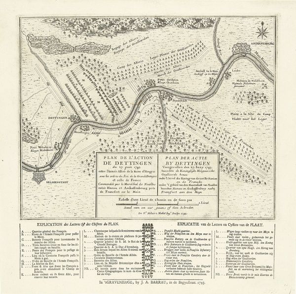
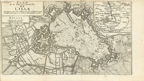
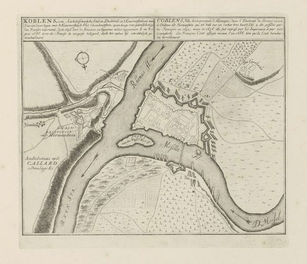
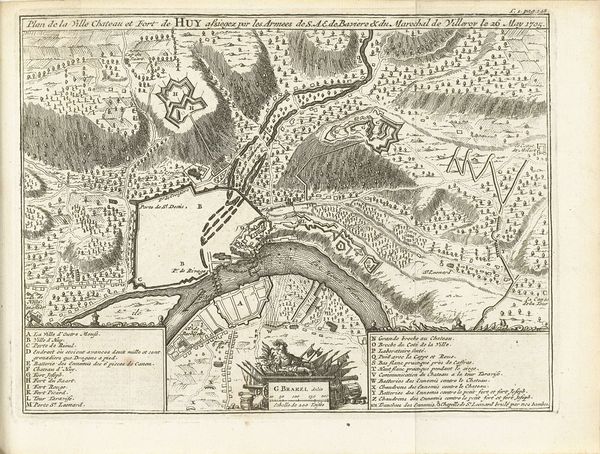
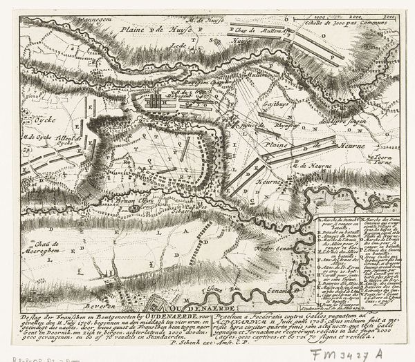
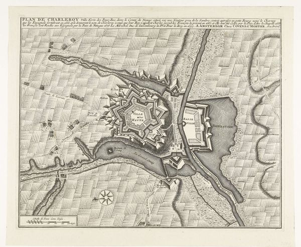
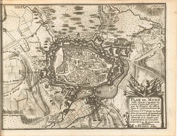
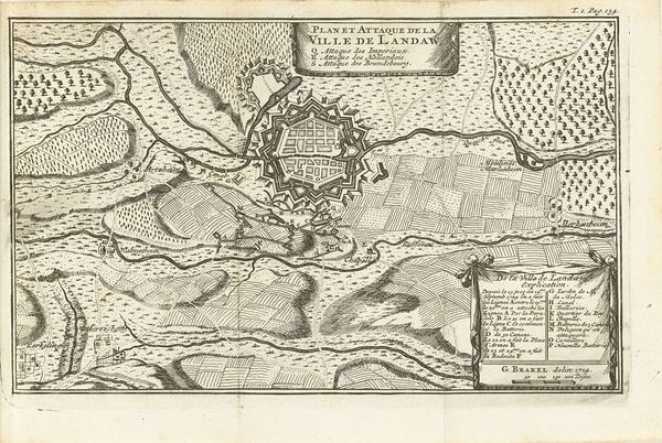
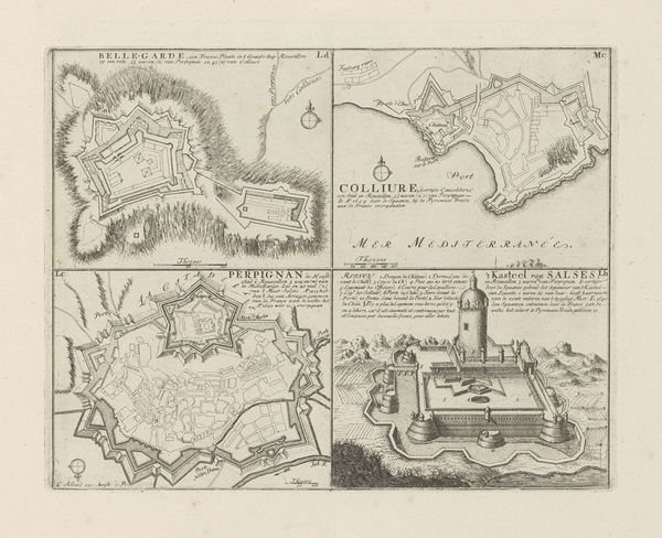
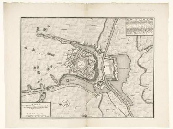
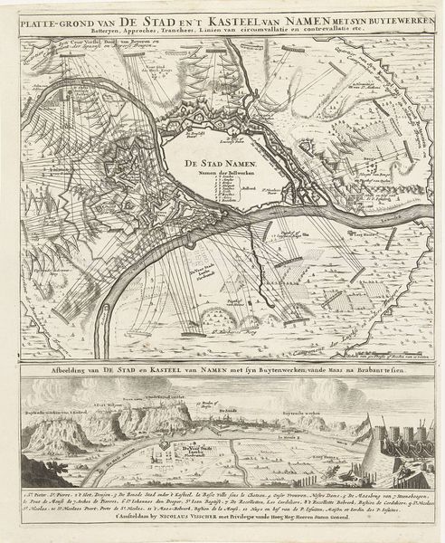
Curator: Here we have "Perpignan en andere steden in Rousillon" from sometime between 1701 and 1733 by Abraham Allard. It's a print housed here at the Rijksmuseum, depicting various cityscapes in an old engraving style. Editor: It's fascinating! I'm immediately drawn to how these cities are rendered; almost as if the act of mapping and control are central to the image itself, which creates a tension between aesthetic representation and its historical usage. How do you see the context of material and the production process shaping our understanding of this piece? Curator: It's true; the very act of creating and circulating such a print reveals the political and economic priorities of the time. Think about the resources required: the engraver's labor, the availability of paper, the printing press itself. The image isn’t just *of* cities, it’s *about* power, specifically cartographic power, how these locations were literally being consumed, understood, and displayed. Does that power dynamic impact how you view the artistic achievement displayed here? Editor: Absolutely. The sharp lines and detailed renderings, all made through a labor-intensive process, underscores a deliberate attempt to catalogue. The intent to convey precision through this laborious approach is evident, a reflection of the engraver’s relationship with material. But doesn't the decision to distribute this as a print further implicate its cultural impact beyond the act of creation? Curator: Precisely! Its reproducibility enabled wider consumption, facilitating an emergent “knowledge” of the depicted land. But this is only knowledge if we understand that it is skewed. Consider its purpose. Did it play a role in commerce? Or the assertion of power by local officials, maybe as propaganda? Such intentions shift it away from the art object into… what? Editor: Maybe, a cultural object or even a document of political administration, where artistry is second to the intentions driving the work's commissioning and distribution. That re-contextualizes my view on what is really important in this picture, highlighting the material conditions in this case were as important as what the picture depicts. Curator: Exactly! Examining how it’s made illuminates *why* it was made. I now understand why I overlooked that originally. Thank you!
Comments
No comments
Be the first to comment and join the conversation on the ultimate creative platform.
More like this