drawing, print, paper, ink, engraving
#
drawing
#
baroque
#
pen drawing
# print
#
landscape
#
paper
#
ink
#
geometric
#
history-painting
#
engraving
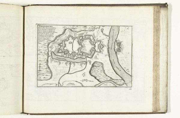
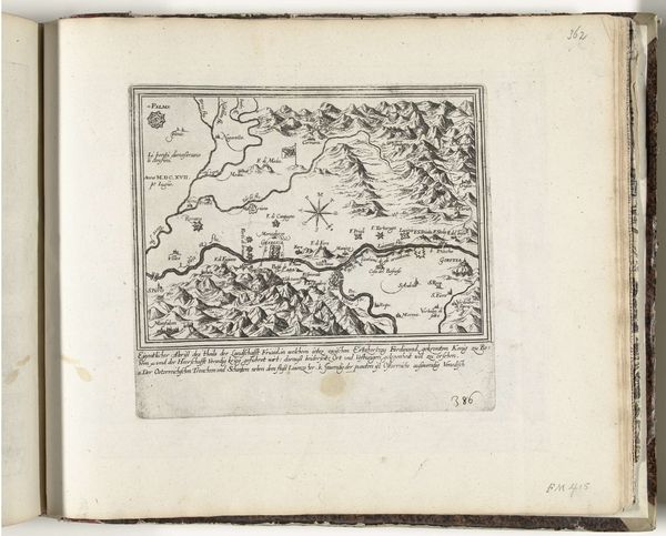
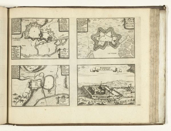
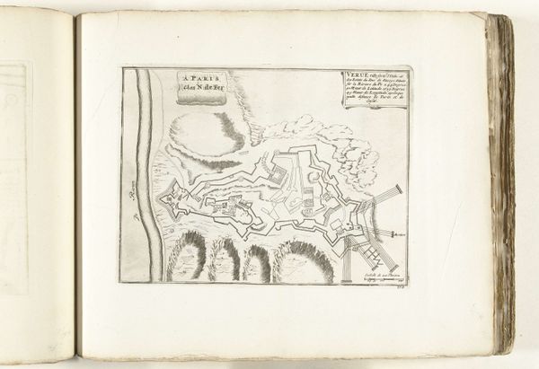
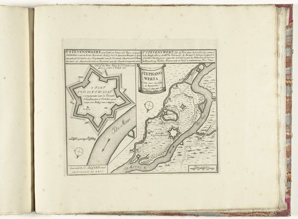
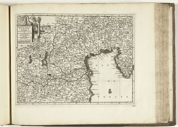
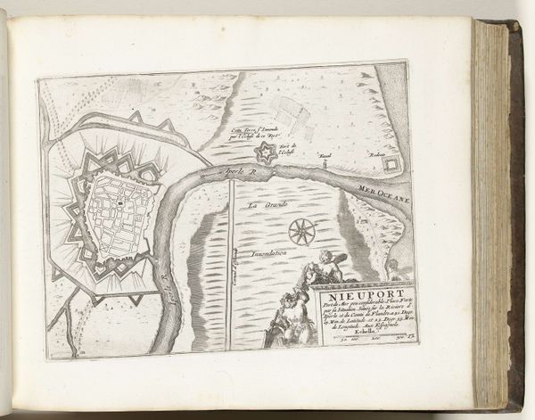
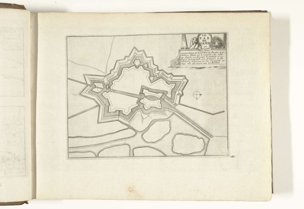
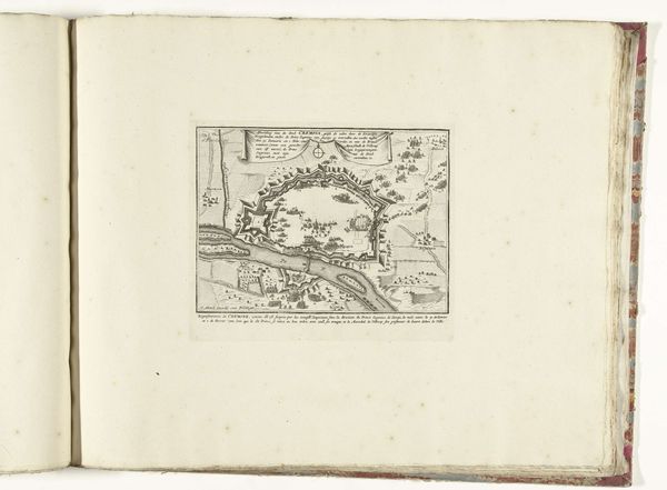
Dimensions: height 232 mm, width 302 mm
Copyright: Rijks Museum: Open Domain
Curator: Look at this fascinating piece: "Kaart van Savoye, 1726," an engraving crafted anonymously during the Baroque era. Editor: It’s incredibly detailed! My first impression is of overwhelming intricacy. All those tiny lines and labels – it creates an almost dizzying visual experience. Curator: It’s more than just decorative; this map serves as a powerful document of its time, reflecting Savoy's geographical and political landscape in 1726. Think about the importance of cartography during a period defined by expanding empires and geopolitical maneuverings. It visualizes power. Editor: From a compositional standpoint, the balance achieved through meticulous engraving is striking. Notice the varying line weights used to define borders and natural features—a semiotic dance of graphic marks forming a whole. Curator: The choice to include symbolic elements within the map, especially near settlements and administrative boundaries, indicates the complex relationships of the region at the time and warrants examination using both feminist theory and cultural studies. We see history refracted. Editor: Absolutely, though consider how the print medium itself shapes our understanding. The engraving process enforces precision, demanding absolute clarity in its execution, leading to this geometrical arrangement of space that transforms the landscape into an abstract design. Curator: Yet the anonymous nature of its creation reminds us that art, even in ostensibly functional forms like maps, is never divorced from socio-economic contexts. The lack of attribution allows us to analyze this artwork less through individual genius, and more as a mirror of collective perceptions and institutional agendas of that time. Who benefits from it is something to ponder. Editor: That's an insightful point. From my perspective, the visual organization facilitates immediate reading, which could have assisted contemporary diplomats with interpreting boundaries and land claims efficiently, emphasizing pragmatism and precision above the subjective artistic impression. Curator: The tension between its practicality and latent implications is really what captures my interest. It reflects the multifaceted identity of Savoy and calls us to examine the intertwined dynamics that molded that era. Editor: Yes, and by understanding those very elements that shape our encounter, we understand it better. Curator: Exactly! What starts as a detailed map, evolves into an illustration of how much maps are themselves informed by ideologies and influence that are still being considered in cultural and political spaces.
Comments
No comments
Be the first to comment and join the conversation on the ultimate creative platform.
More like this