print, etching, architecture
# print
#
etching
#
landscape
#
etching
#
geometric
#
architecture
Dimensions: height 370 mm, width 297 mm
Copyright: Rijks Museum: Open Domain
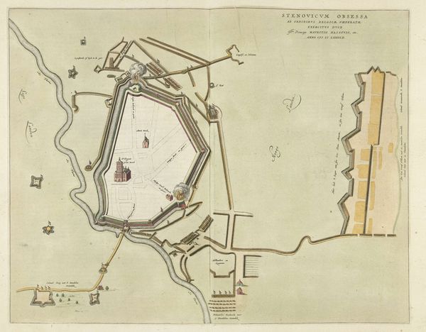
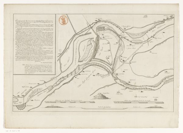
This is an anonymous print from 1692, a "Plattegrond van het oude en het nieuwe Kasteel van Namen" – or floor plan of the old and new castle of Namur. It depicts a landscape shaped by both human engineering and the unyielding force of the natural world. Castles have always been symbols of power, control, and, of course, defense. What this map really reveals is the violence inherent in the landscape. The jagged lines of the fortress walls, the strategic positioning along the rivers, these were all about asserting dominance and protecting territory. But consider also the impact on the lives of those living in and around Namur. For the people of Namur, this wasn't just a map. It was their home, their livelihood, and their history etched onto paper. There's an emotional weight to understanding that this isn't just ink on paper. It's a frozen moment in time, a testament to a past where survival and power were etched into the very ground we stand on. It reminds us to consider whose stories are told and whose are left out when we map our world.
Comments
No comments
Be the first to comment and join the conversation on the ultimate creative platform.
More like this