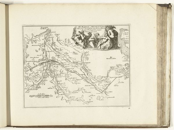
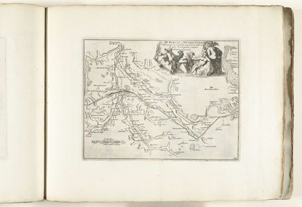
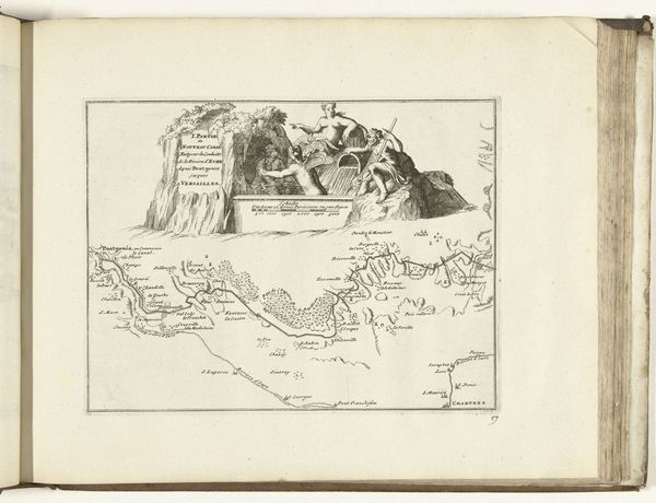
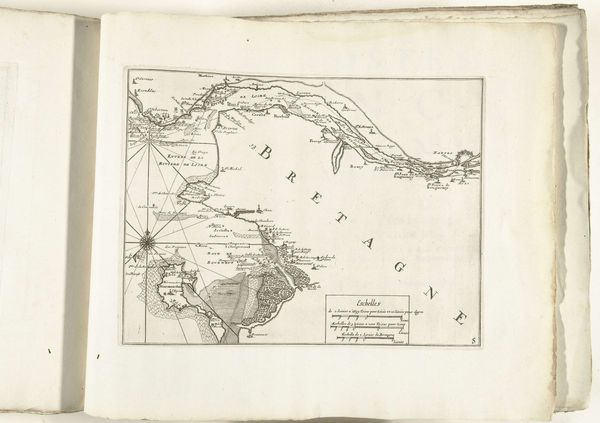
Kaart van het nieuwe kanaal van Pontgouin naar Versailles (deel I), ca. 1693-1696 1693 - 1696
0:00
0:00
anonymous
Rijksmuseum
drawing, print, ink, engraving
#
drawing
# print
#
landscape
#
ink
#
history-painting
#
engraving
Dimensions: height 205 mm, width 270 mm
Copyright: Rijks Museum: Open Domain
Editor: So, this is "Kaart van het nieuwe kanaal van Pontgouin naar Versailles (deel I)," made around 1693-1696 by an anonymous artist. It’s an engraving with ink on what looks like laid paper. The detail is striking; it's amazing that something so functional, like a map, has so much artistry. What stands out to you about this piece? Curator: Immediately, I’m drawn to the map’s function as a document of monumental labor. Can you imagine the social cost, the sheer human effort, of building this canal? We see here not just lines on paper but also a record of forced labor, resource extraction, and engineering skill – a convergence of human and natural materials towards King Louis XIV’s absolute authority. The map itself becomes a commodity. Editor: So you're thinking about it as a record of labor more than a traditional artwork? Curator: Absolutely. Look at the quality of the engraving, the materials themselves. Fine paper, precise lines etched with expensive tools… who had access to these materials and skills? Consider the engraver as a skilled laborer embedded within a system that glorifies power through resource control and the manipulation of the physical landscape. Editor: That's fascinating. I never thought about a map in terms of labor before. Do you think the mapmakers intended to record that aspect, or were they just focused on topographical accuracy? Curator: Probably accuracy was their primary goal. But to look at the image today through a materialist lens is to become aware of the social structures of the time and the consumption practices that facilitated the production and dissemination of an image. Who paid for it? Who was it for? How does it justify resource distribution? It transforms the viewing experience. Editor: I can see that shift. I came in thinking about composition, but now I'm pondering about canal construction. Curator: Exactly! It’s a change of focus. I mean, how often do we pause to examine the politics, class structures, or access to materiality associated with image-making in the 17th Century? Editor: This perspective brings a new angle, focusing on production and what it meant. Thanks for helping me look at it that way. Curator: My pleasure. Thinking about process often allows us to view even common items through a richer and far more human lens.
Comments
No comments
Be the first to comment and join the conversation on the ultimate creative platform.
More like this