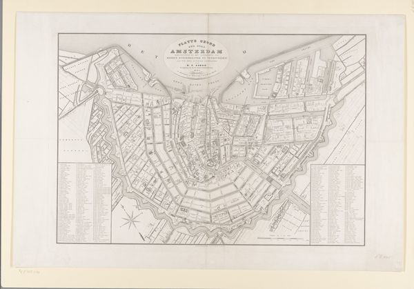
drawing, graphic-art, print, etching
#
drawing
#
graphic-art
# print
#
etching
#
etching
#
architectural drawing
#
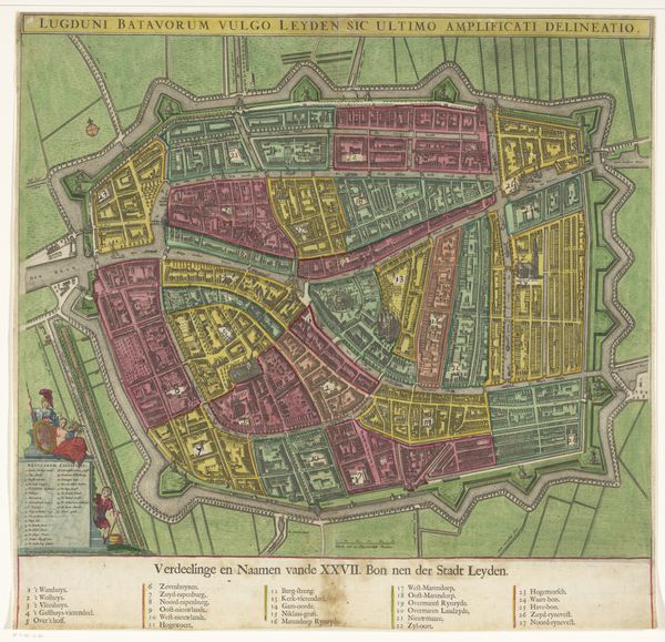
cityscape
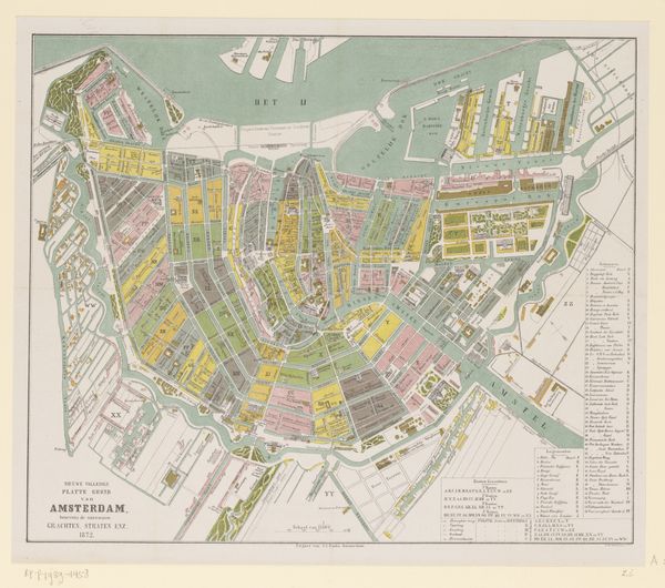
Dimensions: height 461 mm, width 591 mm
Copyright: Rijks Museum: Open Domain
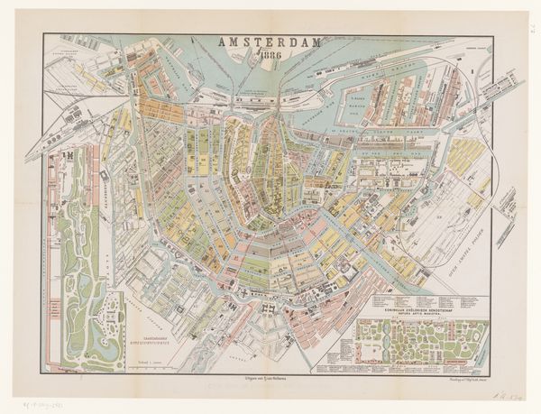
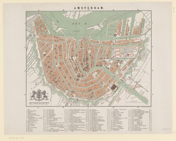
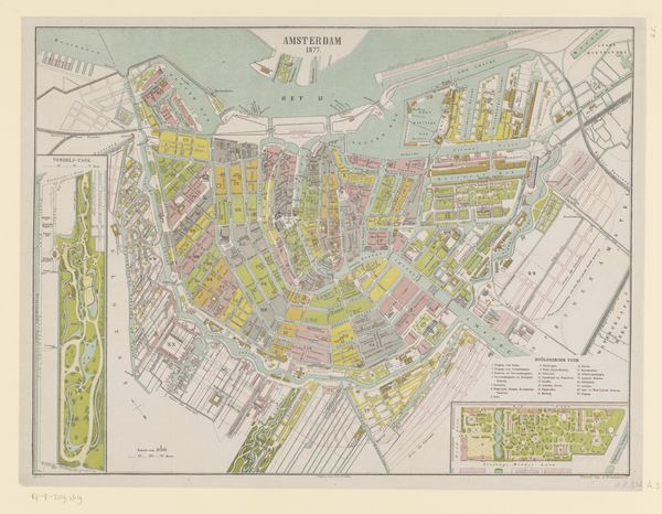
Curator: Looking at this work by Martin Ghys, we can appreciate a lithographic print titled "Plattegrond van Amsterdam," created in 1873. This city map uses etching to visualize the architectural layout of Amsterdam, reflecting 19th-century urban planning. Editor: Wow, I'm immediately struck by the sense of order—almost clinical. The color palette feels muted, lending the piece a somewhat melancholy, bygone air. Do you feel that too? Curator: The subdued colors—mainly pale greens and soft reds—highlight the deliberate imposition of structure onto the organic development of the city, embodying the values of industrial-era efficiency and control. Editor: Control, absolutely. The precision is fascinating. You know, gazing at it like this makes me ponder what lives unfolded within all those meticulously planned streets and structures. Imagine the lives lived behind each pink little rectangle! Curator: Those pink areas would have represented residential and commercial buildings, primarily occupied by burghers, merchants, and laborers of varied socio-economic backgrounds. We must also acknowledge the absent narratives. Maps like these often silenced the experiences of marginalized communities by rendering invisible their homes and histories. Editor: Invisible, yes. It's odd how something so detailed can simultaneously erase stories. How, exactly, do etchings like these inform contemporary discussions around urban spaces? Curator: This map functions as a lens through which we can investigate spatial justice and historical power dynamics. Examining how Amsterdam developed helps reveal systemic biases in urban development, leading to crucial questions on accessibility and equitable resource distribution today. Editor: It’s amazing how something created with an intention can eventually mean something different, become an entirely new object that is, perhaps, critical to its creators' original view. Looking back on this piece from the 21st century, this 1873 blueprint is transformed into something else altogether, I feel. It lives! Curator: Indeed. Engaging with pieces like "Plattegrond van Amsterdam" facilitates a multi-layered critical engagement, inspiring richer comprehension and prompting inquiries that steer us towards inclusive and reflective urban design futures. Editor: Well said. For me, looking at art, especially something as structured as this, helps me realize how fluid meaning is and, in its way, always up for grabs.
Comments
No comments
Be the first to comment and join the conversation on the ultimate creative platform.
More like this