print, engraving
# print
#
pen sketch
#
old engraving style
#
geometric
#
line
#
cityscape
#
engraving
Dimensions: height 239 mm, width 275 mm
Copyright: Rijks Museum: Open Domain
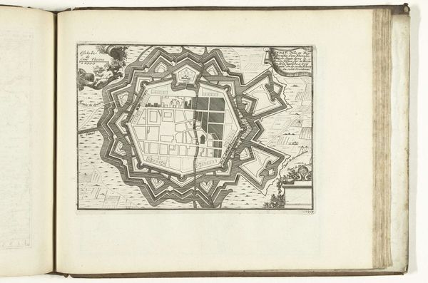
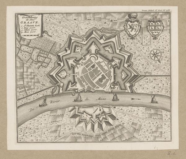
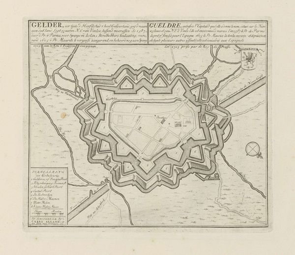
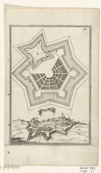
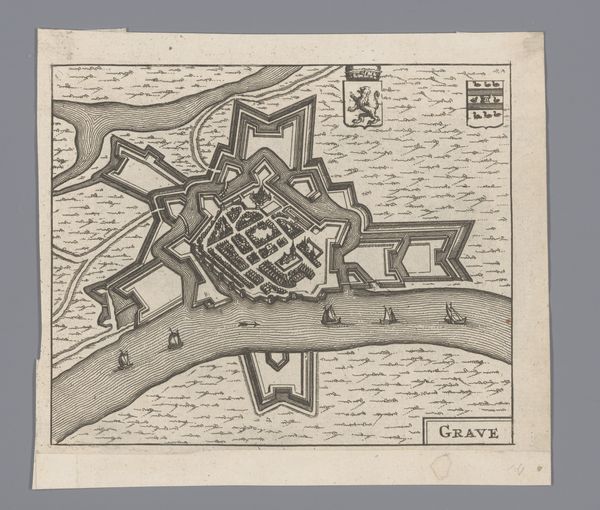
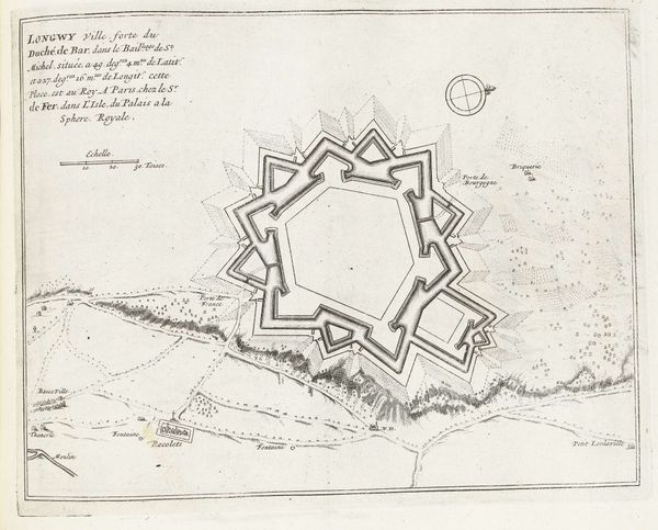
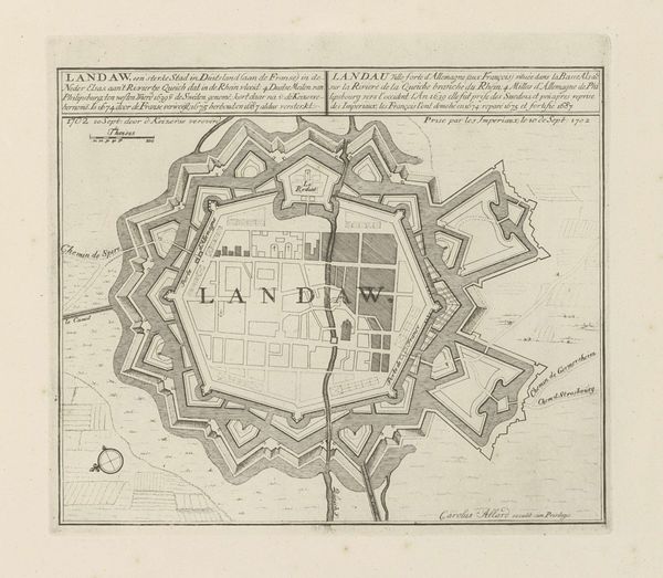
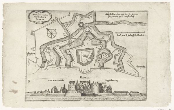
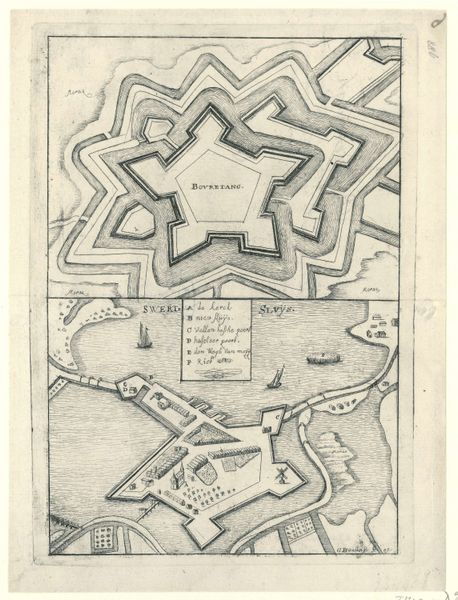
Editor: So, this is Abraham Allard’s "Plattegrond van Naarden," an engraving dating from around 1701 to 1733. It looks like a map of a city, but the whole thing is shaped like a star! What’s the story behind that shape? Curator: That star shape is the key! It's a visual echo of a very specific moment in military history. Think of the star as a symbol – a cultural memory of the "star fort," or bastion fort. These fortifications became popular from the 16th century onwards. The pointed bastions allowed defenders to cover all angles, offering no blind spots. Editor: So it's less about aesthetics and more about… artillery? Curator: Precisely! But aesthetics always plays a role. These shapes also became emblems of power and control, literally shaping the landscape to project authority. Think about the psychological impact – seeing such a clearly defined, defended space. It declares, "We are prepared. We are impenetrable." It’s like a visual language of dominance. Editor: I hadn’t considered the psychological element. It does look very… deliberate. Almost like a puzzle. Was Naarden particularly significant? Curator: Maps of fortifications served a dual purpose. Yes, to plan and build, but also as symbolic representations of civic pride and, crucially, for propaganda. These images celebrated the strength and engineering prowess of the city and the nation. Editor: So, even something as seemingly functional as a city map can be loaded with cultural and political meaning. That’s fascinating. Curator: Exactly. By examining the symbolism inherent in the design – the star shape, the geometric precision – we gain a deeper understanding of the era's values and fears. We recognize it as a container of cultural meaning and continuity. Editor: I see it so differently now. Thanks!
Comments
No comments
Be the first to comment and join the conversation on the ultimate creative platform.
More like this