drawing, print, engraving
#
drawing
#
baroque
# print
#
landscape
#
cityscape
#
history-painting
#
engraving
Dimensions: height 174 mm, width 205 mm
Copyright: Rijks Museum: Open Domain
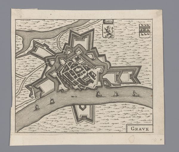
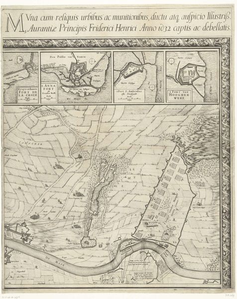
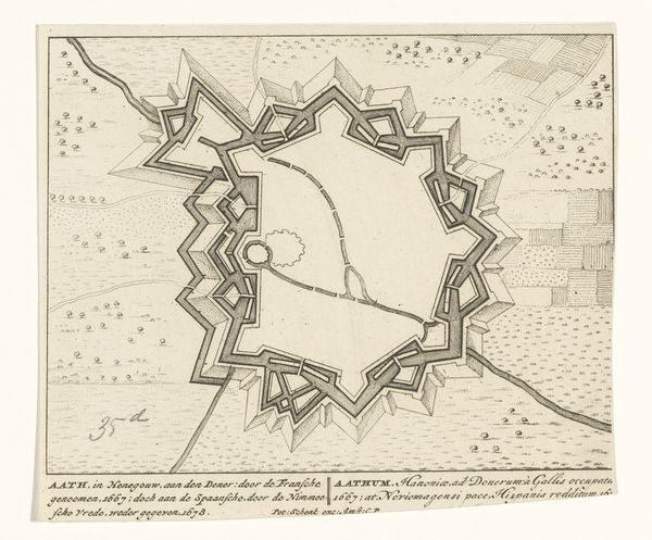
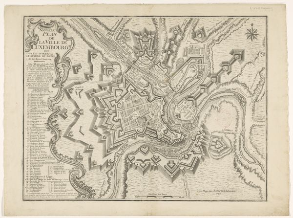
Curator: What strikes you immediately about this Baroque cityscape? The title reads "Plattegrond van Grave" – a town plan, of sorts. Editor: The precision! The etching feels incredibly laborious, a testament to meticulous craft. So many tiny, repetitive marks... you sense the human effort poured into documenting every building, every defense. Curator: Indeed. This anonymous drawing and engraving, circa 1740, uses a complex system of lines, negative space and symbolic rendering of various structures, making it feel more than a straightforward representation. Editor: Right. Beyond mere topography, it's about power, control, military might. See the strategic star-shaped fortifications along the riverbanks? That kind of architecture dictated lives, shaped the flow of commerce and community. Curator: Notice how the graphic treatment organizes a seemingly chaotic collection of buildings. The symmetry, though imposed, almost appears organic— a beautiful paradox inherent in many cities. The visual vocabulary is also quite remarkable— linear hatching indicating texture or depth Editor: You're talking about an aesthetic imposed by those with access to the materials of production. This wasn’t just a rendering, it was a carefully constructed representation serving a specific political purpose. The clean lines might have concealed the daily grind, the mud and hardship of living within those defensive walls. Curator: Of course, maps and prints held immense value—political, commercial, military. The lines represent infrastructure as well as artistic invention. We read history within the carefully controlled space. Editor: Ultimately, what grips me is the contrast between the map’s delicate lines and its implied narrative of conflict and hard work. This drawing has become a monument, not just of a place, but the countless individuals whose lives unfolded there. Curator: A beautiful paradox, I agree. Viewing the architecture within the formal construct invites endless narratives— social structures embedded within stone and line. Editor: It reminds us that every careful stroke is also a record of real, often unseen, labour, reshaping environments and marking history in lasting ways.
Comments
No comments
Be the first to comment and join the conversation on the ultimate creative platform.
More like this