drawing, print, paper, ink, engraving, architecture
#
drawing
#
baroque
# print
#
paper
#
ink
#
geometric
#
line
#
cityscape
#
engraving
#
architecture
Dimensions: height 185 mm, width 271 mm
Copyright: Rijks Museum: Open Domain
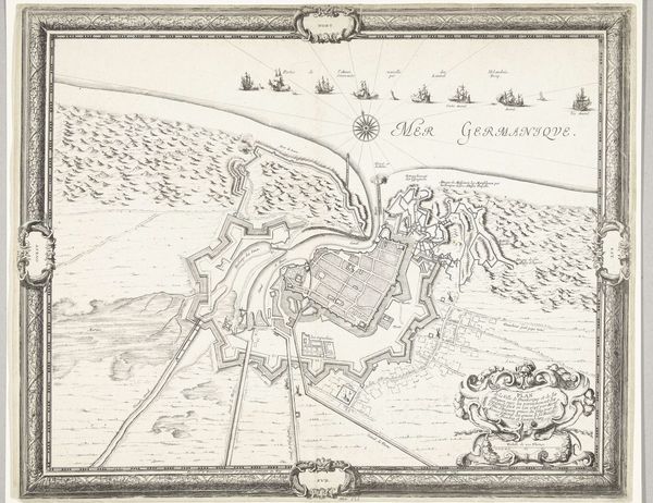
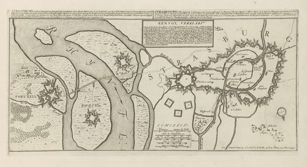
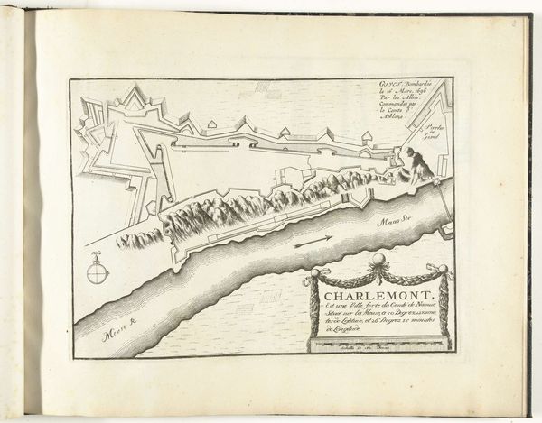
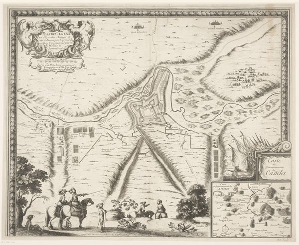
Daniël Marot created this plan of the city Venlo and Fort Sint-Michiel in the 17th or 18th century using etching. The stark lines and precise geometric forms give a sense of order and control. The composition is dominated by two fortress shapes connected by a river. This creates a visual dialogue between the two structures, and how the waterway mediates their relationship. The map uses line and form to communicate military strategy and architectural design. The regular, star-shaped fortifications and the detailed rendering of the landscape suggest a desire to impose structure onto the natural world. This reflects the period's emphasis on rationality and control. The etching's formal qualities serve as signs, representing power, strategy, and the imposition of human will on the landscape. Consider how the artist uses scale and perspective. It not only maps physical space but also conveys ideas about power and knowledge. This is a formal representation of an intellectual framework.
Comments
No comments
Be the first to comment and join the conversation on the ultimate creative platform.
More like this