print, engraving
# print
#
pen illustration
#
15_18th-century
#
cityscape
#
engraving
Dimensions: height 220 mm, width 441 mm
Copyright: Rijks Museum: Open Domain
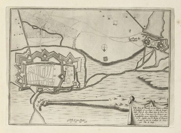
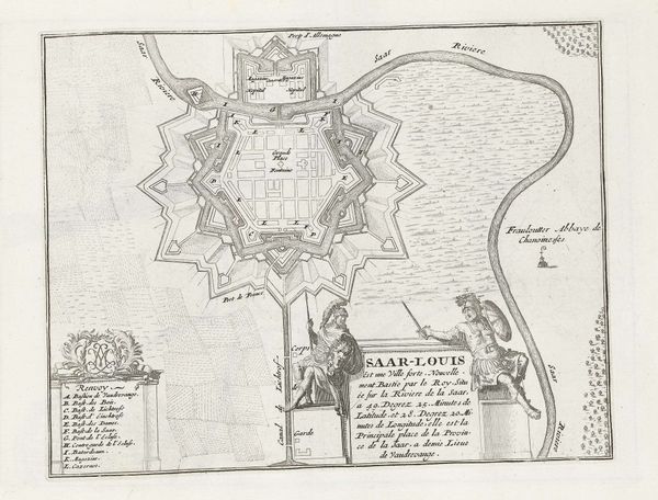
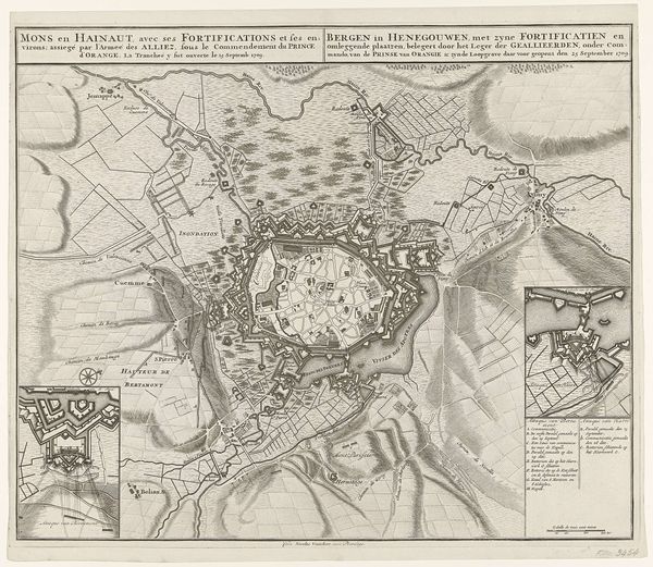
Editor: Here we have "Plattegrond van Straatsburg", a print, an engraving in fact, from somewhere between 1701 and 1733 by Abraham Allard, currently residing at the Rijksmuseum. It is essentially a meticulously detailed map of the city. I'm immediately struck by how… geometric it is, all those precise lines and angles carving up the landscape. What do you see in this piece? Curator: Well, I see a yearning, if you can believe it. These maps weren't just for navigation; they were about claiming space, declaring ownership. Look at the way the fortifications dominate the scene! Star forts, moats – the city's practically wearing armor. It whispers anxieties, doesn't it? Makes you wonder what they were so afraid of losing, back then. Were there wars occurring at this time? Editor: It's true; those defensive structures do project a certain unease. I hadn't really considered the potential conflicts, the history this map is subtly hinting at, maybe a sort of early real estate speculation and how the military landscapes influenced city form? It is much more interesting when looked at in that light, I had originally missed that nuance. What an interesting blend of urban planning and military strategy! Curator: Absolutely, and notice how the city itself, within those formidable walls, is almost… secondary. The emphasis is on control, on boundaries. Perhaps maps are the original NFTs? Define your space and everything beyond doesn't matter as much! I like how you took it to an early real estate point! Editor: That's such an interesting perspective; I hadn't thought of it that way at all! It’s really broadened my understanding of what a seemingly simple map can convey, the early anxieties over geopolitical drama played out. Curator: Exactly. Art, even cartographic art, is never *just* what it seems. Keep looking beneath the surface!
Comments
No comments
Be the first to comment and join the conversation on the ultimate creative platform.
More like this