About this artwork
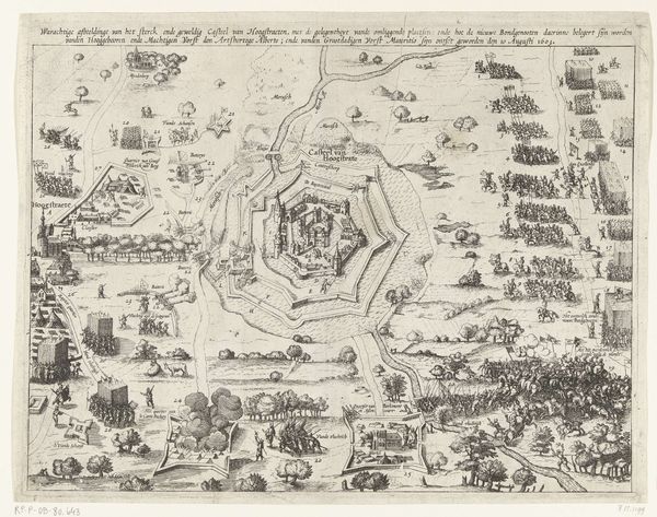
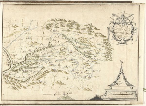
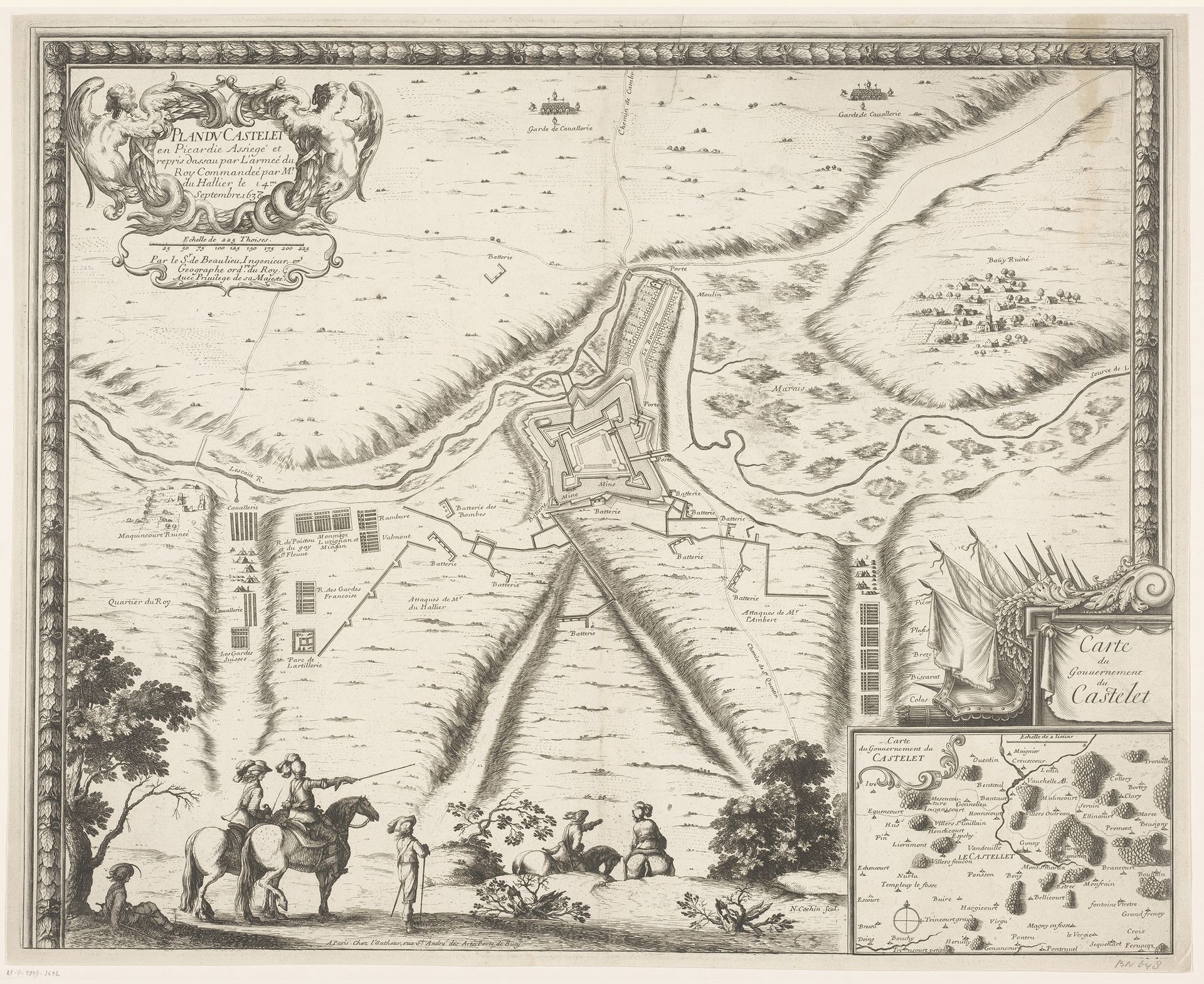
This is Nicolas Cochin’s 1638 engraving, depicting a map of Le Castellet. Note the lower-left vignette: a mounted figure, arm extended, points towards the fortress. This gesture, a form of visual rhetoric, echoes through time. Consider similar depictions in Roman military art, where emperors are shown gesturing authoritatively, claiming dominion over conquered lands. Or even earlier, in Egyptian art, pharaohs point outwards to symbolize power. This assertive gesture, repeated across cultures, underscores a fundamental human desire: to survey, possess, and control. Now, observe how such symbolic gestures tap into our collective memory. This motif, passed down through history, triggers a deep psychological response. The act of pointing evokes a sense of command, reminding us of our primal instincts related to territoriality and dominion, a visual echo resonating from antiquity to the age of gunpowder and empires. This reveals the power of visual symbols to transcend time, continually reshaping and reasserting themselves in the human psyche.
Artwork details
- Medium
- drawing, print, engraving
- Dimensions
- height 430 mm, width 532 mm
- Location
- Rijksmuseum
- Copyright
- Rijks Museum: Open Domain
Tags
drawing
pen drawing
geometric
line
history-painting
engraving
Comments
Be the first to share your thoughts about this work.
About this artwork
This is Nicolas Cochin’s 1638 engraving, depicting a map of Le Castellet. Note the lower-left vignette: a mounted figure, arm extended, points towards the fortress. This gesture, a form of visual rhetoric, echoes through time. Consider similar depictions in Roman military art, where emperors are shown gesturing authoritatively, claiming dominion over conquered lands. Or even earlier, in Egyptian art, pharaohs point outwards to symbolize power. This assertive gesture, repeated across cultures, underscores a fundamental human desire: to survey, possess, and control. Now, observe how such symbolic gestures tap into our collective memory. This motif, passed down through history, triggers a deep psychological response. The act of pointing evokes a sense of command, reminding us of our primal instincts related to territoriality and dominion, a visual echo resonating from antiquity to the age of gunpowder and empires. This reveals the power of visual symbols to transcend time, continually reshaping and reasserting themselves in the human psyche.
Comments
Be the first to share your thoughts about this work.