print, metal, engraving
#
baroque
# print
#
metal
#
old engraving style
#
cityscape
#
engraving
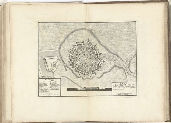
Dimensions: height 309 mm, width 403 mm
Copyright: Rijks Museum: Open Domain
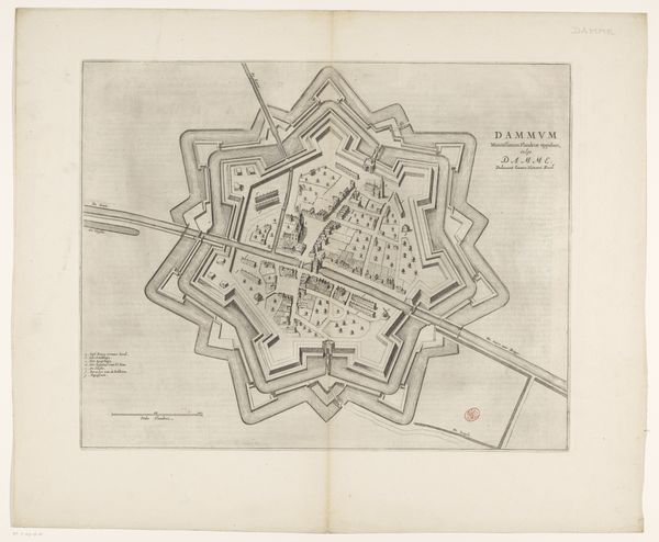
This is an un-dated etched map of Philippeville made by an anonymous artist. Created during a time of territorial disputes and military strategy, this map offers insights into the complex power dynamics of the era. It meticulously details the fortifications of Philippeville, emphasizing the city's strategic importance. The precise lines and geometric shapes transform the landscape into a site of control. This relates to a broader historical context of colonization and domination, as maps were tools for claiming territories and exerting power over both land and people. Consider the emotional implications of such a carefully planned defense. The map embodies both the ambition to protect and the underlying fear of invasion. It prompts questions about the lives of those within and outside its walls, and about the human cost of these strategic designs. How does this cartographic representation shape our understanding of history and our place within it?
Comments
No comments
Be the first to comment and join the conversation on the ultimate creative platform.
More like this