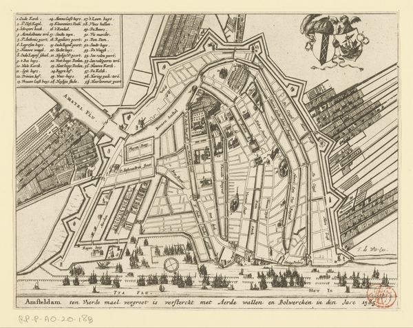
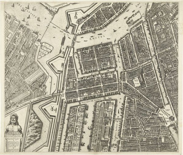
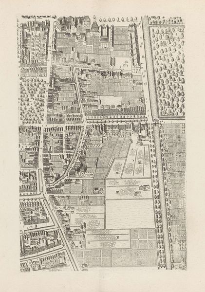
Plattegrond van Amsterdam (blad middenrechts), 1625 1625
0:00
0:00
balthasarfloriszvanberckenrode
Rijksmuseum
print, engraving, architecture
#
pen and ink
#
architectural sketch
#
dutch-golden-age
# print
#
geometric
#
cityscape
#
engraving
#
architecture
Dimensions: height 458 mm, width 532 mm
Copyright: Rijks Museum: Open Domain
Editor: Here we have Balthasar Florisz. van Berckenrode's "Plattegrond van Amsterdam," created in 1625, a pen and ink and engraving print from the Rijksmuseum collection. I’m immediately struck by the precision of the linework. It almost feels abstract in its detail. What do you see in this piece? Curator: The compositional structure here is fascinating. Notice the grid-like arrangement and how it guides the viewer’s eye. Each line, each shape contributes to a balanced and, indeed, precise rendering of urban space. Van Berckenrode expertly employs the visual elements available to create a comprehensive plan. Observe how he uses variations in line weight to differentiate architectural features. Editor: So, the form itself is the primary subject here? Even beyond the historical depiction? Curator: Precisely. One could argue the historical context serves as mere pretext for exploring form and representation. The city is rendered as a network of lines, shapes, and negative space, all carefully considered. Do you notice any patterns within the architectural features? Editor: I do now! The houses seem uniformly represented but I’m drawn to the canals—the curves act in contrast with the orthogonal layout of everything else. It really accentuates the geometric forms. Curator: Exactly. These curves, strategically placed, underscore the otherwise unwavering geometrical foundation. Ultimately, it showcases a complex interplay between organic and inorganic forms. A visual symphony of urban planning. Editor: I hadn't thought of it that way, focusing on its abstract qualities. It changes my perception of the piece. Thanks! Curator: And I am pleased to find its cultural meaning being derived from those architectural qualities.
Comments
No comments
Be the first to comment and join the conversation on the ultimate creative platform.
More like this