drawing, graphic-art, print, engraving
#
drawing
#
graphic-art
#
baroque
#
dutch-golden-age
# print
#
geometric
#
engraving
Dimensions: height 460 mm, width 543 mm
Copyright: Rijks Museum: Open Domain
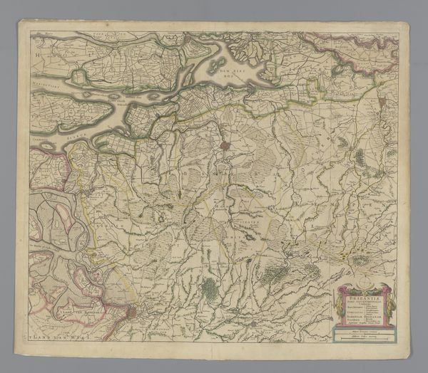
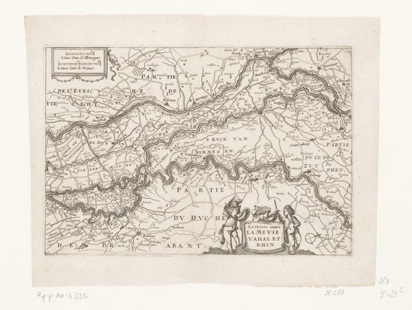
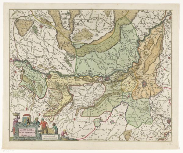
Curator: Here we have an intriguing piece: "Kaart van het oostelijk deel van Brabant," a map of the eastern part of Brabant, dating back to 1638. It's an engraving, a print, really a piece of graphic art, residing here at the Rijksmuseum. Editor: It’s captivating! An entire world meticulously rendered. But it also gives me this distinct feeling of... anxious precision. So much detail, but somehow also unsettlingly incomplete. Curator: Incompleteness in maps of this era wasn’t uncommon, think about the economic interests behind cartography. A map held value far beyond geographical knowledge; it was a tool of power, trade, and control. This engraving reflects not just the land itself but the ambitions of those commissioning such works, who might have been merchants, nobles, or even military strategists, concerned with the resource flows. Editor: And it makes you think about the engraver too—someone meticulously tracing these lines, trying to bring a place, a region, to life on this flat surface. Did they ever wonder about the impact of their work, or the people living in all the locations? Curator: Undoubtedly. The very act of representing space in this manner changes our relationship with it. Consider the material—paper—relatively accessible but valuable. And the process of engraving, which allowed for multiple copies. It democratized geographical knowledge, or at least a specific, authorized version of it. Editor: But isn't there a danger too, in seeing the land reduced to lines and names, missing all of the smells and the colours, the people. I can't help but imagine myself travelling it; but looking only to its details while forgetting to *feel* it! Curator: Precisely. Maps offer control at the expense of sensory experience. Notice how the towns, waterways and fields appear –almost a checklist. This tension – between knowledge and experience, power and perception - makes the print quite potent. Editor: It feels a bit melancholy now. A ghost of a landscape, so detailed yet missing the spark. The lives lived along all those routes. Still, it's a potent thing isn't it? Looking at history in a purely technical way, a stark document laid bare for examination. Curator: It certainly allows us a layered view of the past; considering what was considered worthy of record in 1638 is a fascinating enterprise. Editor: True! It makes me rethink maps entirely, it truly transforms cartography from mere record to an amazing, flawed creation!
Comments
No comments
Be the first to comment and join the conversation on the ultimate creative platform.
More like this