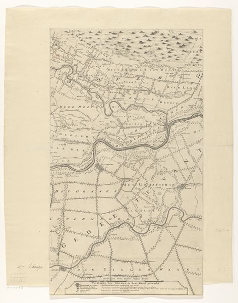
Housing, Improved: Great Britain, England. Hampstead. Garden Suburb (Copartnership and Private) Plans of Estate and Cottages: Co-partnership Housing: England: Map of Hampstead Garden Suburb showing arrangement of houses on lots. 9-Feb
0:00
0:00
Dimensions: image: 40.6 x 20.3 cm (16 x 8 in.)
Copyright: CC0 1.0
Editor: Here we have "Housing, Improved: Great Britain, England. Hampstead. Garden Suburb" by Charles Wade. It appears to be a map showing the layout of houses and plots. How do you interpret this work, especially considering its function as a plan? Curator: As a materialist, I see this map as a document reflecting the social and economic conditions of its time. Look at the very deliberate arrangement. It speaks to labor and the planning of resources. How does the idea of "improved" housing relate to the social context of urban planning and class structures? Editor: So, you’re saying it's not just a map, but a statement about the process of building communities and the materials used, viewed through a social lens? Curator: Precisely! Examining its materiality—the paper, ink, printing process—allows us to understand its production and distribution, and therefore, its impact on shaping social space. Editor: That's a great point; I had not considered the means of production! Thank you.
Comments
No comments
Be the first to comment and join the conversation on the ultimate creative platform.
More like this