drawing, print, ink, pen, engraving
#
drawing
#
baroque
# print
#
ink
#
pen
#
cityscape
#
history-painting
#
engraving
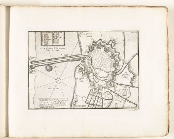
Dimensions: height 205 mm, width 278 mm
Copyright: Rijks Museum: Open Domain
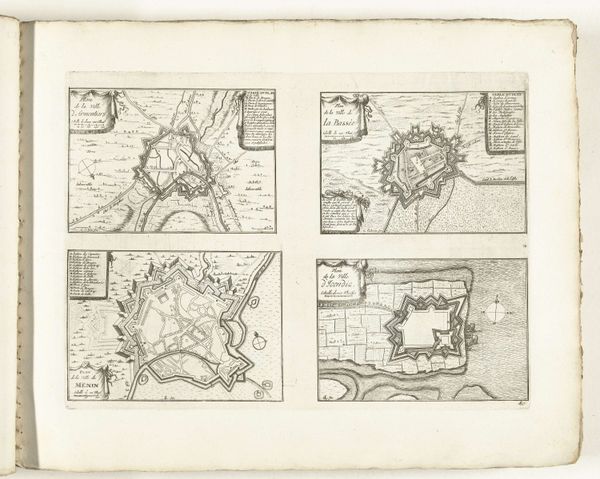
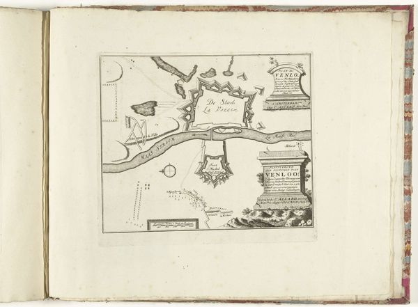
This is a map of Dunkirk, created between 1693 and 1696 by an anonymous artist. Observe the fortified city, its ramparts forming a star-like pattern. This motif, common in military architecture, is not merely functional. The star fort, a symbol of power and protection, echoes through history. Consider the ancient ziggurats, their stepped forms rising toward the heavens, or the medieval castles with their concentric walls. In each, we see a human desire to impose order and control over the environment. But there is also a psychological dimension at play. The act of fortification speaks to our primal fears—of invasion, of the unknown, of chaos itself. Across time, these fortified structures have taken on new meanings. In some cultures, they represent spiritual enlightenment, in others, political dominance. The star fort of Dunkirk, though built for defense, taps into this deep well of collective memory, reminding us of our enduring quest for security in an uncertain world.
Comments
No comments
Be the first to comment and join the conversation on the ultimate creative platform.
More like this