drawing, print, paper, ink
#
drawing
#
baroque
# print
#
landscape
#
paper
#
ink
#
cityscape
Dimensions: height 148 mm, width 177 mm
Copyright: Rijks Museum: Open Domain
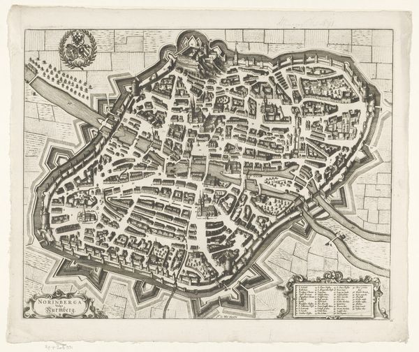
This is Gaspar Bouttats’s etching of Woerden, made sometime around 1672, now held in the Rijksmuseum. The dominant visual element here is the geometric pattern of the town’s layout, neatly encased within its defensive star-shaped walls. The town’s structures are rendered as a series of linear forms, creating a microcosm of order and containment. The map's formal structure goes beyond simple representation; it's a statement about control and power. The rigid lines and precise angles of the fortifications speak to a desire to impose order on both space and society. In semiotic terms, the town becomes a sign, its visual components encoding messages about military strategy, urban planning, and social organization. Consider how the map itself functions as a tool, not just for navigation, but also for asserting dominance. It presents a world neatly categorized and controlled, a vision that reflects the broader philosophical concerns of the time. The map is more than an image; it's an embodiment of a worldview, inviting ongoing interpretation within our cultural and historical understanding.
Comments
No comments
Be the first to comment and join the conversation on the ultimate creative platform.
More like this