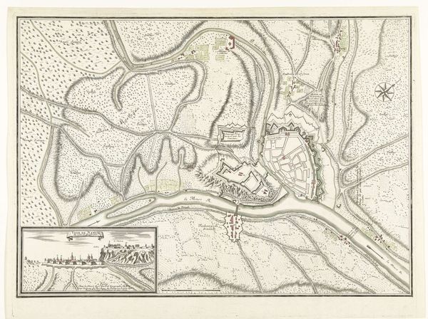
drawing, print, paper, ink
#
drawing
# print
#
landscape
#
paper
#
ink
#
geometric
#
cityscape
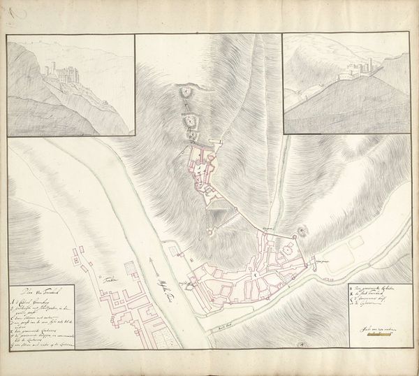
Dimensions: height 415 mm, width 1170 mm
Copyright: Rijks Museum: Open Domain
Editor: This is "Plattegrond van Trier, 1705" created by Samuel Du Ry de Champdoré using ink on paper. Looking at this landscape rendering, it’s hard to get a grasp of the space; it's not how we'd make a map today. What can you tell me about how cityscapes and their visual representations evolved during this period? Curator: This piece is intriguing precisely because it clashes with modern mapping conventions. Before satellite imagery and precise surveying techniques, city maps like these served a very different purpose. It’s more than just geography, wouldn't you agree? Editor: I do! I imagine its intention might be more...symbolic. Curator: Exactly. This map serves to communicate power, control, and knowledge, rather than providing purely navigational data. It's propaganda, in a sense, asserting a certain dominion over the territory, for who and by who? Editor: So it was commissioned perhaps to legitimize the person commissioning the map? And did this depiction change the socio-political relationship with this city and the patrons/residents/etc.? Curator: Precisely! Its distribution shapes perception, contributing to how Trier was understood and managed. How does thinking of it as a socio-political object shift your view of the piece? Editor: That gives me a lot to think about... it definitely places it into the political realm! So much more than a simple geographic aid. I'll have to keep my eyes open for similar implications going forward. Curator: Wonderful, paying attention to the context can reveal profound connections to the forces that shape societies and culture.
Comments
No comments
Be the first to comment and join the conversation on the ultimate creative platform.
More like this