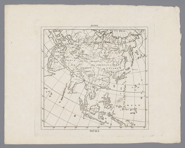
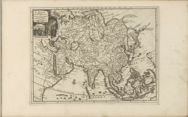
Kaart van Afrika, Azie, Europa en Oceanië, voor scheepstochten van de Nederlanden naar Oost-Indië 1753
0:00
0:00
anonymous
Rijksmuseum
print, engraving
#
baroque
# print
#
landscape
#
genre-painting
#
engraving
Dimensions: height 365 mm, width 323 mm
Copyright: Rijks Museum: Open Domain
This is an old map of Africa, Asia, Europe and Oceania, intended to guide Dutch voyages to the East Indies. Its anonymous creation speaks volumes about the period's maritime exploration and colonial ambitions. Consider the map not just as a geographical tool, but as a statement of power. The detailed coastlines and trade routes highlight the economic interests driving these voyages. Imagine the lives of the sailors, merchants, and the indigenous populations who were impacted by these encounters, and how the narratives of race, gender, and class are embedded in the act of mapping itself. This map serves to legitimize the colonial project. Through this bird's-eye view, we are invited to reflect on the legacy of exploration and its lasting impact on global power dynamics, and to consider the human costs associated with these voyages.
Comments
No comments
Be the first to comment and join the conversation on the ultimate creative platform.
More like this