drawing, print, ink, engraving, architecture
#
drawing
#
baroque
# print
#
ink
#
cityscape
#
engraving
#
architecture
Dimensions: height 222 mm, width 293 mm
Copyright: Rijks Museum: Open Domain
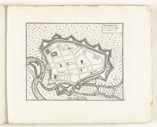
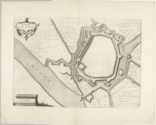
Curator: Looking at this artwork "Plattegrond van Rheinberg, 1726", created in 1726, a detailed drawing blending ink, print, and engraving, found at the Rijksmuseum, I can see a really stunning example of Baroque cityscape rendering. It depicts a bird's-eye view of the town, almost unnervingly neat. Editor: It feels so… controlled, doesn't it? I immediately think of diagrams of the mind, all sharp corners and contained spaces, like someone meticulously organizing their anxieties on paper. What kind of stories do you think are etched in that city? Curator: The walled city is a potent symbol. Beyond military fortifications, they represent order, control, and the imposition of human will upon nature. Each precise line, each angled bastion is about power and protection. They are also about status, announcing, "We are organized; we are civilized!" Editor: Do you feel like there is something slightly ominous, or is that me just letting my imagination wander? Like a cage disguised as protection, cutting off from the wider world... Even those little dots representing the treeline looks quite sinister when viewed as a defensive asset to surround and constrict the city. Curator: Definitely ominous, but a good artist must also be a cartographer of both hope and fear. These defensive systems also point toward trade and culture that flourished in spite of the fear. The Rhine acted as its main artery. We must imagine vibrant and diverse community interactions behind its rigid walls. The artist would seek to convey these complexities. Editor: True. The river brings a breath of dynamism in the otherwise regimented landscape, a channel for exchange and perhaps, escape. I suppose that these maps are always charged objects. And, this makes me want to excavate these past experiences even further, to understand why such defenses are necessary and to understand the toll on its inhabitants who relied on them. Curator: In short, a city is always more than the sum of its lines on a map. What looks neat to us carries narratives of strife and resilience, penned by hands both skilled and emotionally invested. Thanks for offering a compelling and sobering lens, Editor. Editor: It’s what they say about any type of map: The map is not the territory. Thank you, as always, for unveiling its deeper layers, Artist.
Comments
No comments
Be the first to comment and join the conversation on the ultimate creative platform.
More like this