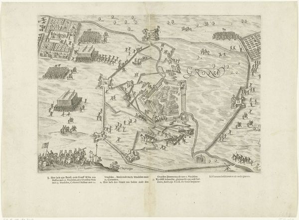
drawing, print, ink, engraving
#
drawing
#
ink drawing
#
medieval
#
pen drawing
# print
#
ink
#
cityscape
#
engraving
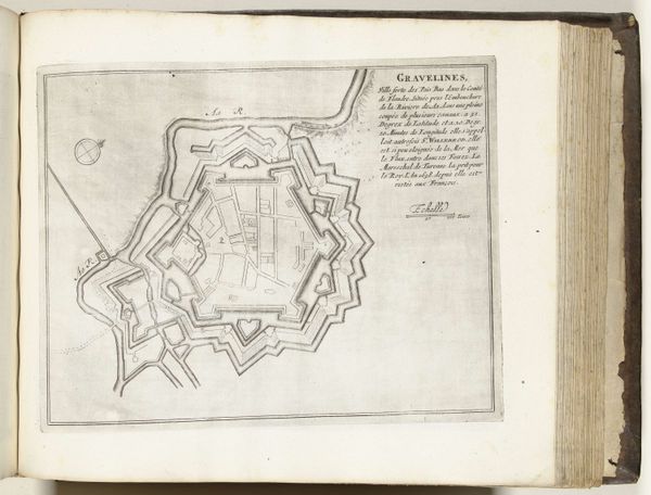
Dimensions: height 370 mm, width 435 mm
Copyright: Rijks Museum: Open Domain
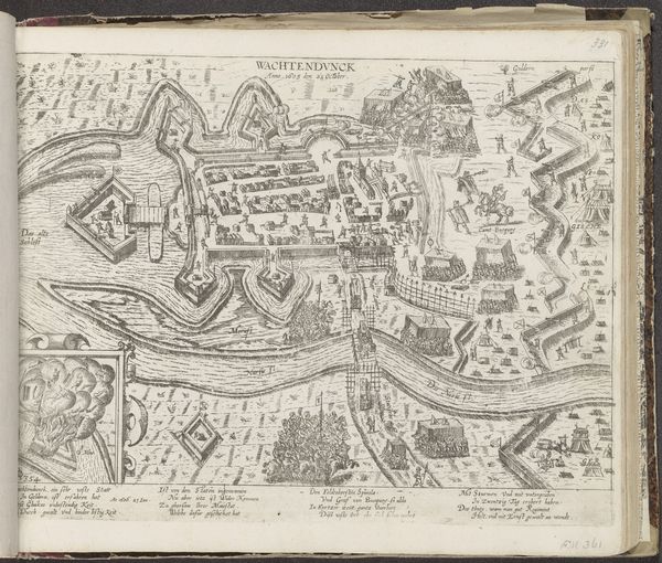
Curator: Looking at this image, I am immediately struck by the precision and order imposed upon the landscape. It’s so different from the organic sprawl we expect today. Editor: I agree; there’s a powerful sense of control conveyed. The artwork here is titled "Plattegrond van Maubeuge, 1709," a drawing and print using ink and engraving by Jacobus Harrewijn. The piece renders a city as a diagram of power, almost an architectural jewel. Curator: Exactly! Fortified cities carry such symbolic weight. The geometric perfection represents a society’s desire to control not just physical space but also the social order within. The star shape and the thick walls scream defensibility, a safe haven, but also a limitation on freedom, in a way. Editor: That’s an interesting reading. Thinking about materiality, these engravings required skilled artisans. The work of planning the city would necessitate multiple roles— surveying the land and strategizing with draftsmen, all impacting how people related to it. Every line etched into that copper plate represents human labor. I also think the uniformity hides so many processes needed to achieve order! Curator: Yes, this image operates on multiple layers of visual coding! I read the image as aspiration toward something larger. We could consider the social psychology behind this map. The grid structure imposed on our world gives us security and control of land that previously wasn’t there; we see a constructed utopia rather than real lives being led. Even the detailed skyline—which is quite different than the stark order presented by the map below, brings me joy and hints at a thriving city behind impenetrable defenses. Editor: Thinking about the engraver, it suggests the power and access of such craftsmanship. Not everyone has access to this process of representation. So who did it serve, this desire for perfect order? Were there even dissenting voices within the city itself that get omitted in these maps of authority? It's the contrast between meticulous technique and potential societal division. Curator: I am in agreement; as this cartographic artifact speaks volumes about not only architectural prowess, but power, too! Editor: For me, it speaks of layers of manual and material operations needed in realizing an idea. It offers another layer to our perceptions beyond representation.
Comments
No comments
Be the first to comment and join the conversation on the ultimate creative platform.
More like this