drawing, graphic-art, print, etching, architecture
#
drawing
#
graphic-art
#
map drawing
#
dutch-golden-age
# print
#
etching
#
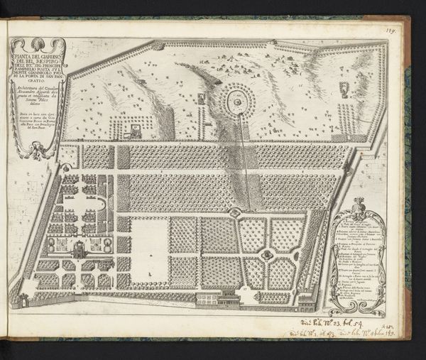
architectural plan
#
architectural drawing
#
architecture drawing
#
cityscape
#
architecture
Dimensions: height 352 mm, width 403 mm
Copyright: Rijks Museum: Open Domain
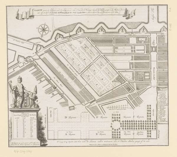
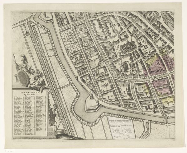
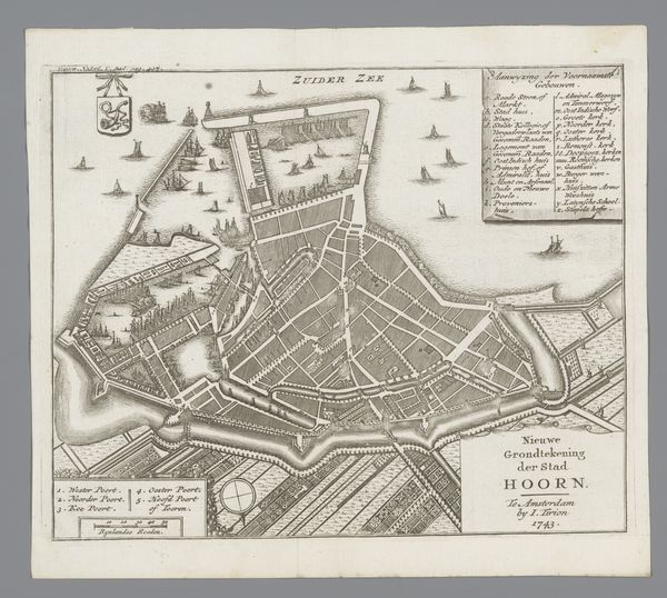
This is Bastiaen Stopendael’s “Plattegrond met ontwerp voor de Nieuwe Plantage,” made in the late 17th century, a detailed rendering of Amsterdam’s urban planning. The printmaking technique— likely etching or engraving—is crucial here. These processes allowed for the precise replication and widespread distribution of designs. Look closely, and you see not just an aesthetic object, but a tool of governance. This isn’t just a representation of space, but an instrument of power. The sharp lines and ordered layout reflect a desire to control and manage urban development. Printmaking was fundamental to the Dutch Golden Age economy, allowing for the mass production of images, which fueled trade and commerce. Stopendael’s map is a document of Amsterdam’s transformation into a major economic hub. It invites us to consider the intricate relationship between artistic production, urban development, and the rise of capitalism.
Comments
No comments
Be the first to comment and join the conversation on the ultimate creative platform.
More like this