drawing, print, ink, pen
#
drawing
#
baroque
# print
#
landscape
#
ink
#
pen-ink sketch
#
pen
Dimensions: height 230 mm, width 290 mm
Copyright: Rijks Museum: Open Domain
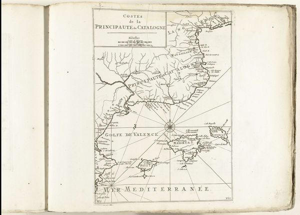
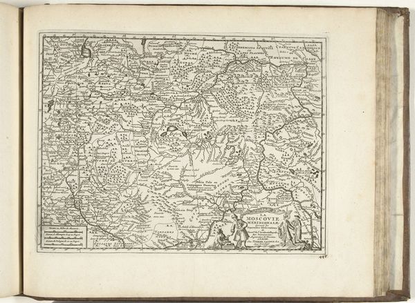
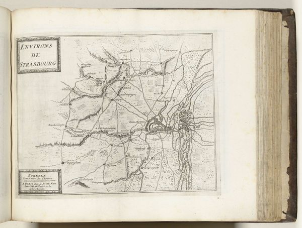
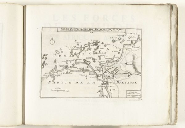
Curator: This is a map titled “Kaart de omgeving van Palamos en Gerona,” dating roughly from 1694 to 1696, held here at the Rijksmuseum. It's rendered in pen and ink. Editor: There's something quite stark about this, a certain tension in the way the delicate linework depicts such a strategic landscape. The coast is clear, the mountains defined—the print feels like an economic resource more than an aesthetic object. Curator: Indeed. These kinds of maps were incredibly valuable. Mapping wasn't just a science; it was power. Knowledge of the land—its resources, its topography—informed military strategy and facilitated trade routes. The social and political implications are profound. Editor: Exactly, think of the paper itself – its source, production. And the ink, how it was mixed, the skill of the hand drawing each line. Each mark connects back to resources, labor. The precision here, almost austere, suggests a commissioned work. Curator: I agree. Looking closer, you see the topography carefully delineated, presumably for military planners. Its very creation would have been funded by the state to consolidate their image and maintain power during potential conflicts. Editor: It speaks of control, of the act of surveying turning land into property, transforming geography into capital through pen and ink, literally defining it in this case, but who controlled that access, who saw this rendering versus another, a local person's memory for instance. Curator: The interesting part about the cartography itself is that while the map presents itself as objective truth, the way it was circulated could impact how those places were conceptualized. For individuals back then in Palamos and Gerona and our view on these locations now! Editor: So much rests in how something is crafted and presented. I'm drawn to how that coast is depicted, a tangible resource even in reproduction through prints. This piece is a record, really a trace of extraction itself. Curator: I am reminded of how art acts as a window into a place's cultural significance at one historical moment, which also has significant and material repercussions. It's so vital to see maps as culturally contingent documents and never as value-neutral objects. Editor: Yes, that's where the core of its artistic significance really lies—as both tool and cultural marker.
Comments
No comments
Be the first to comment and join the conversation on the ultimate creative platform.
More like this