print, etching, engraving
#
baroque
# print
#
etching
#
cityscape
#
history-painting
#
engraving
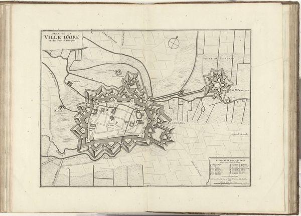
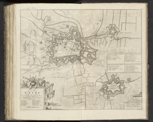
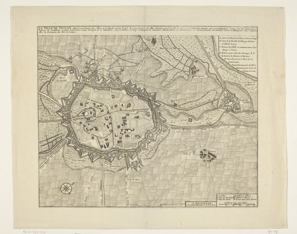
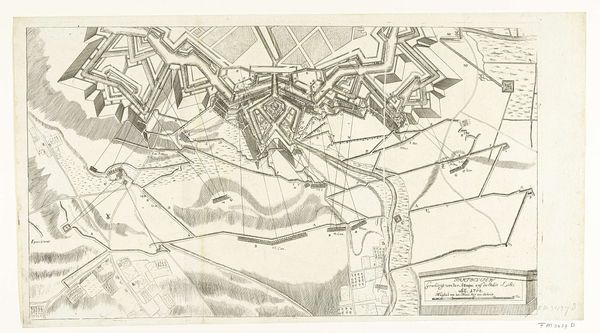
Dimensions: height 408 mm, width 505 mm
Copyright: Rijks Museum: Open Domain
Editor: Here we have "Siege of Aire, 1710," by Jacobus Deur, a print utilizing etching and engraving techniques. The city appears almost as an organic, fortified growth on the landscape. How do you interpret this work? Curator: This isn't just a picturesque view; it's a carefully constructed representation of power and control, meticulously crafted for strategic, often propagandistic purposes. Let's consider the materiality of the print itself. Engravings like these weren't just art; they were commodities, reproduced and disseminated to inform and influence public opinion regarding military campaigns and geopolitical interests. The detailed rendering signifies meticulous planning, the sheer labor invested in creating this object mirroring the investment in the siege itself. Notice the geometrical forms—how does that connect with the military objective of the artwork? Editor: The fort's star shape stands out, seeming both beautiful and menacing in its exactitude. Curator: Exactly! This geometrical precision speaks to the burgeoning field of military engineering at the time. The very act of mapping, etching, and printing reflects an effort to dominate not just the territory but also the visual representation of that territory. The lines, the annotations, are a form of claiming space, turning it into a commodity. The production process mirrors the process of conquest. What does this suggest about how maps themselves function? Editor: I see how the materials used contribute to this representation of power through labor. Curator: Precisely. Now we understand the piece is about both craft and consumption and how they are intertwined with the labor of production. Editor: I hadn’t considered it in those terms before, that’s an interesting perspective!
Comments
No comments
Be the first to comment and join the conversation on the ultimate creative platform.
More like this