drawing, paper, ink
#
drawing
#
baroque
#
paper
#
ink
#
geometric
#
cityscape
Dimensions: height 502 mm, width 595 mm
Copyright: Rijks Museum: Open Domain
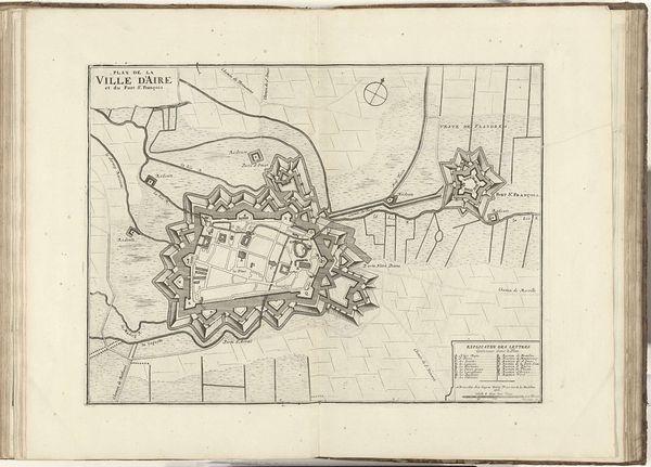
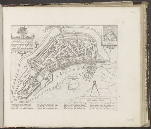
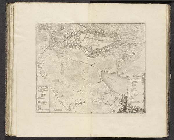
Pieter van Call the Younger created this map of the siege of Aire in 1710. Maps like these were not just about geography, they were tools of power, shaping how people understood territory and conflict. This map illustrates the siege of Aire-sur-la-Lys, a town that was part of a larger power struggle in the region. It reflects a time of shifting alliances and military strategies, where control over land meant control over resources and people. Consider the emotional weight of this detailed depiction of conflict. Van Call wasn't just drawing lines on paper; he was capturing a moment of intense human experience, where lives were disrupted and futures were uncertain. How did the cartographer wrestle with issues of representation, and who benefited from the narrative this map created? It makes you wonder about the personal stories of the soldiers and civilians who lived through this siege.
Comments
No comments
Be the first to comment and join the conversation on the ultimate creative platform.
More like this