#
landscape illustration sketch
#
aged paper
#
botanical illustration
#
personal sketchbook
#
botanical photography
#
botanical drawing
#
watercolour illustration
#
storyboard and sketchbook work
#
botanical art
#
warm toned green
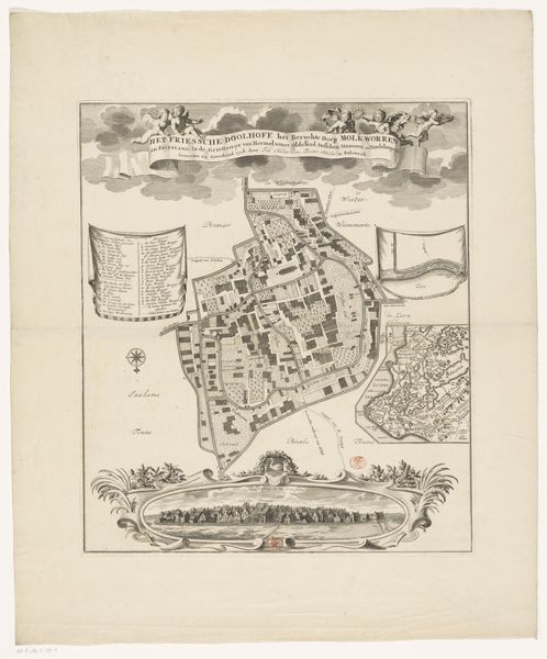
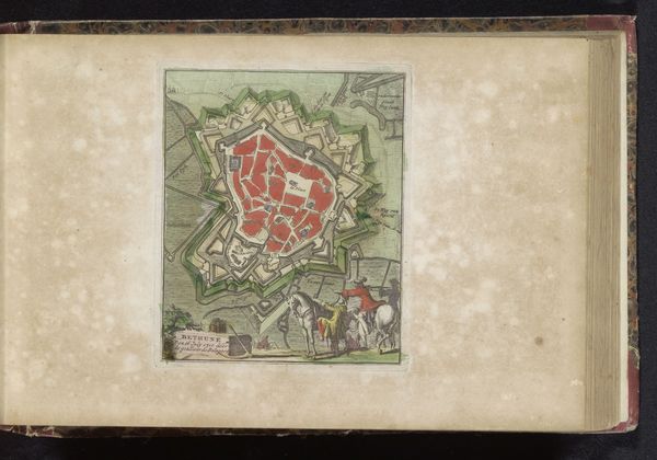
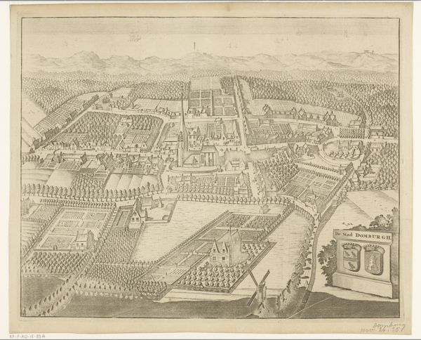
Dimensions: height 480 mm, width 419 mm
Copyright: Rijks Museum: Open Domain
Editor: This is "Plattegrond van Molkwerum," an anonymous piece created sometime between 1718 and 1799. It looks like a detailed map, perhaps watercolor on aged paper. The meticulous depiction of the village layout really strikes me. What catches your eye in this work? Curator: The level of detail speaks volumes about production, doesn't it? This isn't just about representing space; it’s a document tied to land ownership, resource management, perhaps even military strategy. Consider the labour involved in surveying, drafting, and then the printing process, likely engraving. Editor: So, you're saying the map isn’t just a representation, but also an object of labour itself? Curator: Precisely. How does the rendering of the town - with each structure, road and land division represented – illuminate the economy and social dynamics of 18th century Molkwerum? Think about the materials used - paper, pigments - their sources and trade routes. Were these readily available locally or were they luxury imports? Editor: That's interesting, the materials tell a story of commerce and maybe even power. Does the color palette choice impact your interpretation? Curator: Yes, the earth tones and reds...are these accurate, or symbolic choices? Consider their materiality. Are these locally sourced pigments that communicate specific geography, or are the colour choices made to convey specific associations about the people who may use it? Editor: I hadn't considered that perspective before, focusing on the practical resources behind even a seemingly simple image. Curator: Art, at its core, is tied to materiality. The physical choices manifest cultural, social, and economic choices. Thinking about it in this way opens up a richer understanding of the artist’s world and the function of the art. Editor: I agree. Looking at it this way, the map becomes a fascinating record of the time, way beyond just geography! Thanks, that gives me a lot to think about.
Comments
No comments
Be the first to comment and join the conversation on the ultimate creative platform.
More like this