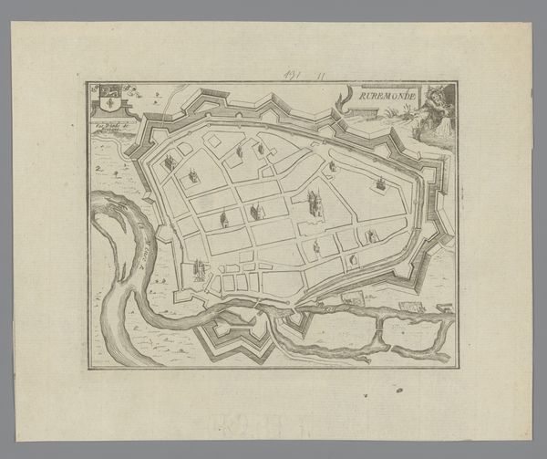
drawing, print, watercolor, ink
drawing
landscape
watercolor
ink
coloured pencil
genre-painting
watercolor
Dimensions: height 157 mm, width 129 mm
Copyright: Rijks Museum: Open Domain
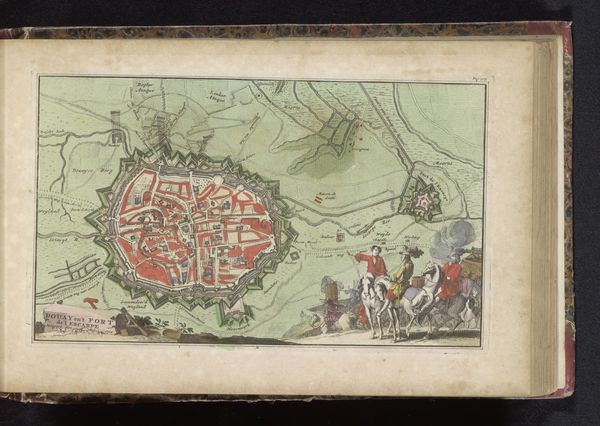
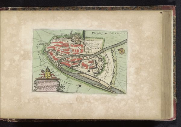
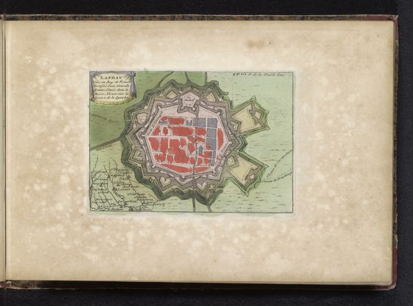
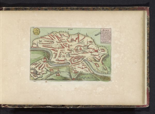
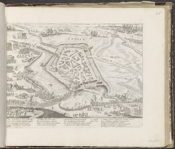
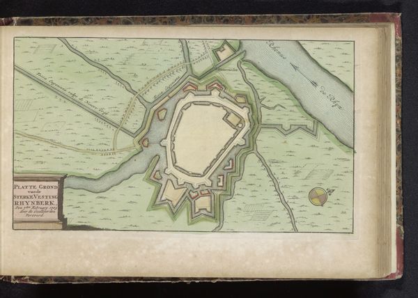
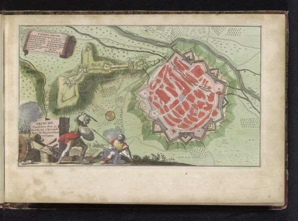
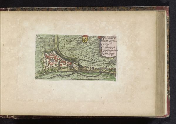
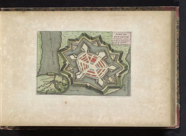
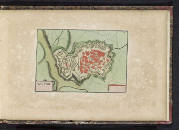
Curator: Let's turn our attention to this intriguing print, titled "Beleg van Béthune, 1710," made around 1735 by an anonymous artist. The work combines ink and watercolor to depict the siege of Béthune. Editor: It feels… ordered. The star-shaped fortification is almost a meditative pattern, until you notice the small troop movements. Makes war seem less chaotic, more like an urban planning exercise, doesn’t it? Curator: Exactly. This rendering isn't merely illustrative, it's strategic. Notice how the precise lines delineate the defensive infrastructure, emphasizing the tactical layout and the significant engineering effort required for both the siege and the defense of the city. Editor: And that pop of red within the city walls! A fiery heart amidst all that regimented green. Is that symbolic, do you think? The heart of the community? Curator: Possibly, or perhaps just practical highlighting. But consider also, that this kind of print served a purpose. These images informed public perception of military campaigns. They helped shape narratives of power and control. We see military campaigns transformed into visually digestible and palatable propaganda. Editor: Propaganda as pretty pastel plans! I like that, very Machiavellian. The coloured pencil also gives it that approachable, everyman vibe. It's not this inaccessible high art, but an infographic digestible for the interested layman. Curator: And its function would reach far beyond mere military personnel. Think of landowners who needed to decide for or against military funding or any wealthy layman investing in military infrastructure. This print is as informative as it is picturesque. The medium speaks to both the intellect and a growing desire for images for the rising bourgeoisie. Editor: Thinking about its creation—the ink, the watercolour—it's kind of delicate considering it's showing scenes of brutal military strategy, isn't it? Curator: An apt contrast, underscoring the complex ways that art interprets conflict. And what strikes you most now that we've delved deeper? Editor: The surprising beauty of war planning; something so meticulous masking so much potential destruction. A beautiful veneer. Curator: Indeed, it's in this intersection of cartography, warfare, and artistry where its enduring fascination lies.
Comments
No comments
Be the first to comment and join the conversation on the ultimate creative platform.