print, engraving, architecture
#
aged paper
#
dutch-golden-age
# print
#
old engraving style
#
cityscape
#
engraving
#
architecture
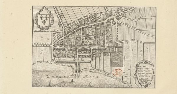
Dimensions: height 205 mm, width 255 mm
Copyright: Rijks Museum: Open Domain
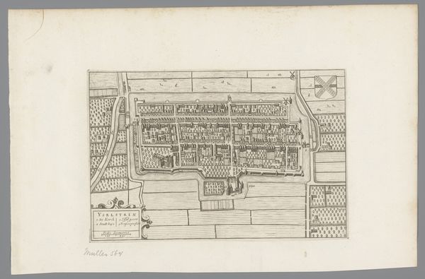
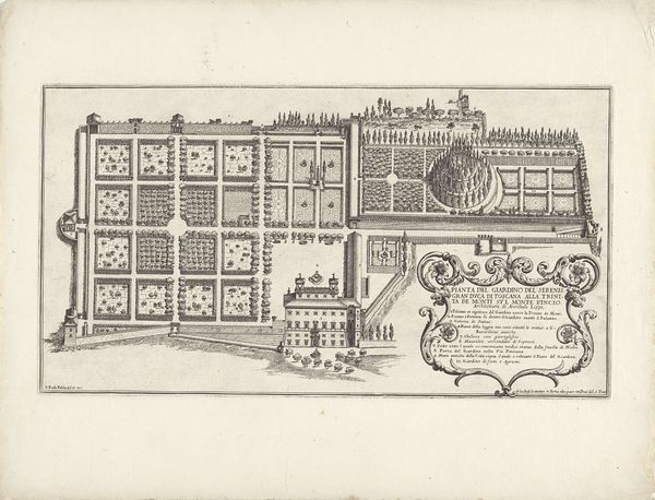
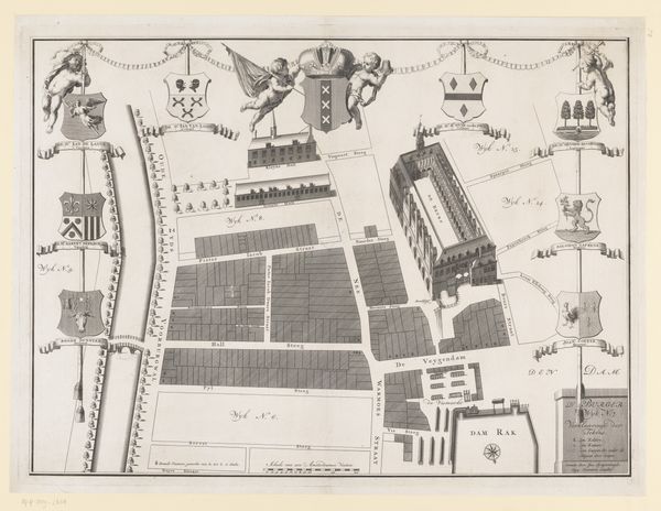
This is an anonymous plan of Beverwijk, created with etching. The composition is defined by a grid-like structure, meticulously detailing the layout of the town and its surroundings. Fields, waterways, and buildings are rendered with a precise linearity. Observe how the etcher uses line to delineate space. This technique echoes the period's interest in rationalizing space and understanding the world through observation and measurement. This plan isn’t just a representation of space, but also an assertion of control over it. The town is neatly organized, each block and field carefully marked. Consider how this relates to broader philosophical themes of the time. The Age of Reason saw the rise of systematic thought, which is reflected in this map's organized structure. It embodies a desire to categorize and understand the world. Ultimately, the plan invites us to reflect on how the human desire for order shapes our perception and representation of space.
Comments
No comments
Be the first to comment and join the conversation on the ultimate creative platform.
More like this