Dimensions: height 321 mm, width 354 mm
Copyright: Rijks Museum: Open Domain
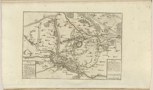
This anonymous map, titled "Kaart van de laatste krijgsmanoeuvres van Civilis, 69-70", or "Map of the last war maneuvers of Civilis" plots the strategies of a historical figure whose name echoes across time. It portrays the theater of war, tracing Civilis’s maneuvers, a leader of the Batavian rebellion against Roman rule in 69-70 AD. The map's detailed inscriptions and careful lines tell a story of resistance against an empire, marking not just geographical locations but also the sites of struggle and negotiation. In an era marked by colonial expansion, maps such as these helped to define territories, cultures and power dynamics. This particular map freezes a moment when the tensions between subjugation and autonomy hung in the balance. We are left to imagine the emotional weight of these military decisions, the stakes involved, the lives impacted. Maps like this one not only chart physical territories, but also map out the complexities of identity, resistance, and the human cost of conflict.
Comments
No comments
Be the first to comment and join the conversation on the ultimate creative platform.
More like this