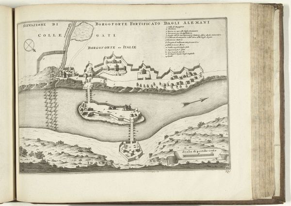
print, engraving
#
baroque
# print
#
landscape
#
engraving
Dimensions: height 241 mm, width 155 mm
Copyright: Rijks Museum: Open Domain
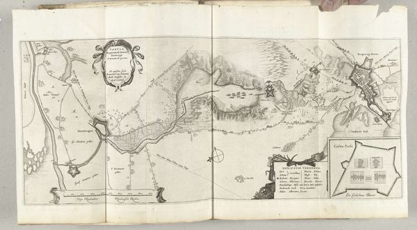
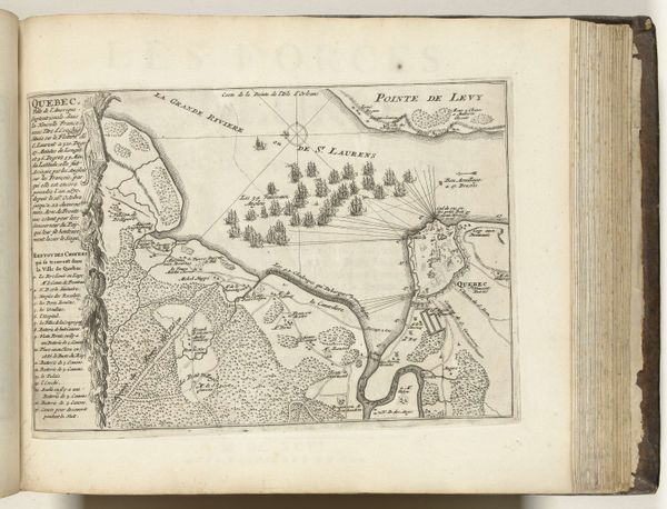
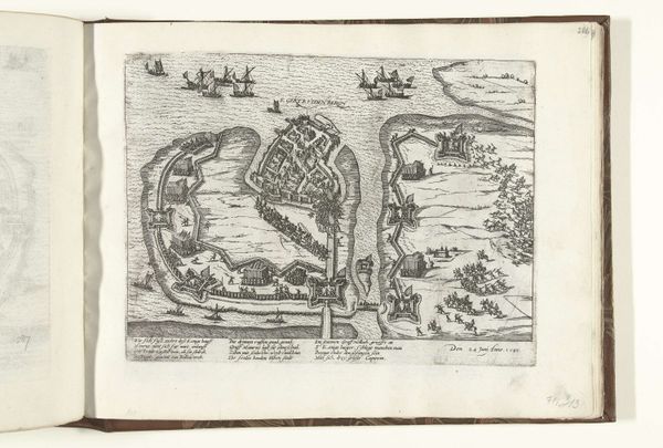
Editor: Here we have a fascinating engraving from 1625-1626 titled "Blad met twee kaarten van het beleg van Breda," or "Sheet with two maps of the siege of Breda." It's currently held at the Rijksmuseum. The starkness of the black lines against the page creates a striking visual, giving it an almost brutal feel. How do you interpret this work? Curator: It's crucial to remember that maps from this period weren't just about geographical accuracy. They were deeply enmeshed with political power and propaganda. What do you notice about how Breda is represented in each map, and what might the artist be communicating about the siege itself through these choices? Editor: Well, the top map seems to show lines connecting points outside the city. It looks like an attack strategy maybe? The second map is more focused on the land around the city, depicting what could be farmlands or other resources? Curator: Exactly. These aren't neutral depictions; they highlight military strategy and control of resources, vital during a siege. Consider the socio-political context: The Eighty Years’ War was fundamentally a struggle for Dutch independence. These maps visually assert dominance, even during a prolonged and difficult siege. Think about whose perspective is prioritized and who is marginalized by this representation. Whose story is not being told here? Editor: That’s a good point. It’s definitely told from the perspective of the attackers, seemingly glorifying their strategy and ignoring the plight of the people inside Breda. It feels almost…clinical in its detachment. Curator: Precisely. Maps, like any artwork, are never truly objective. They are constructions, laden with ideology. Analyzing them critically allows us to unpack not only the historical events but also the power dynamics at play and to remember that history is written (and drawn) by the victors. Editor: I never thought of maps in that way. It makes me wonder what other stories are hidden in plain sight. Curator: This is just the beginning. Keep questioning and looking beyond the surface. The world is a complicated place, so should art analysis.
Comments
No comments
Be the first to comment and join the conversation on the ultimate creative platform.
More like this