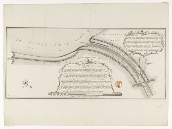
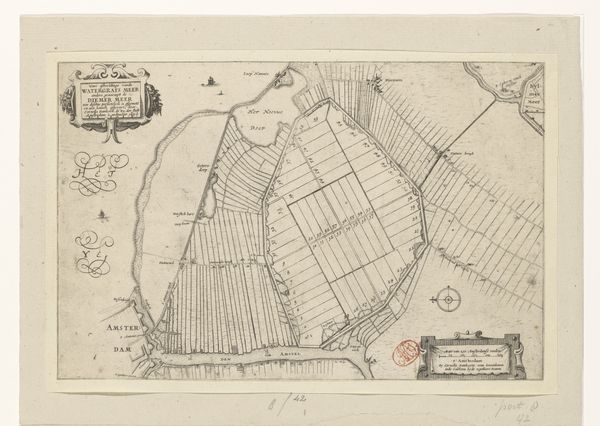
Kaart van de landerijen ten westen van de Kostverlorenvaart te Amsterdam 1767
0:00
0:00
anonymous
Rijksmuseum
drawing, print, paper, ink, engraving
#
drawing
#
dutch-golden-age
# print
#
landscape
#
paper
#
ink
#
geometric
#
line
#
cityscape
#
engraving
#
realism
Dimensions: height 246 mm, width 475 mm
Copyright: Rijks Museum: Open Domain
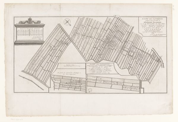
This is an anonymous map of farmland to the west of the Kostverlorenvaart canal in Amsterdam. It was made with pen and ink, probably sometime in the 18th century. While appearing merely descriptive, this map participates in the visual codes of property ownership and land management, especially with its neat delineation of individual land plots. In the Dutch Golden Age, land reclamation and efficient agriculture became intertwined with national identity and economic prosperity, and these maps record the imposition of human order onto the natural world. The very act of mapping served to reinforce the notion of controlled space, ripe for cultivation and profit. This image underscores the significance of archival research, as tracing the ownership and utilization of these farmlands through historical records could reveal much about the social and economic dynamics of the time, reflecting the intricate relationship between land, power, and representation.
Comments
No comments
Be the first to comment and join the conversation on the ultimate creative platform.
More like this