About this artwork
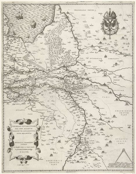
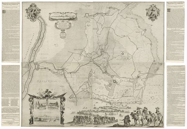
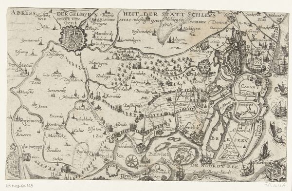
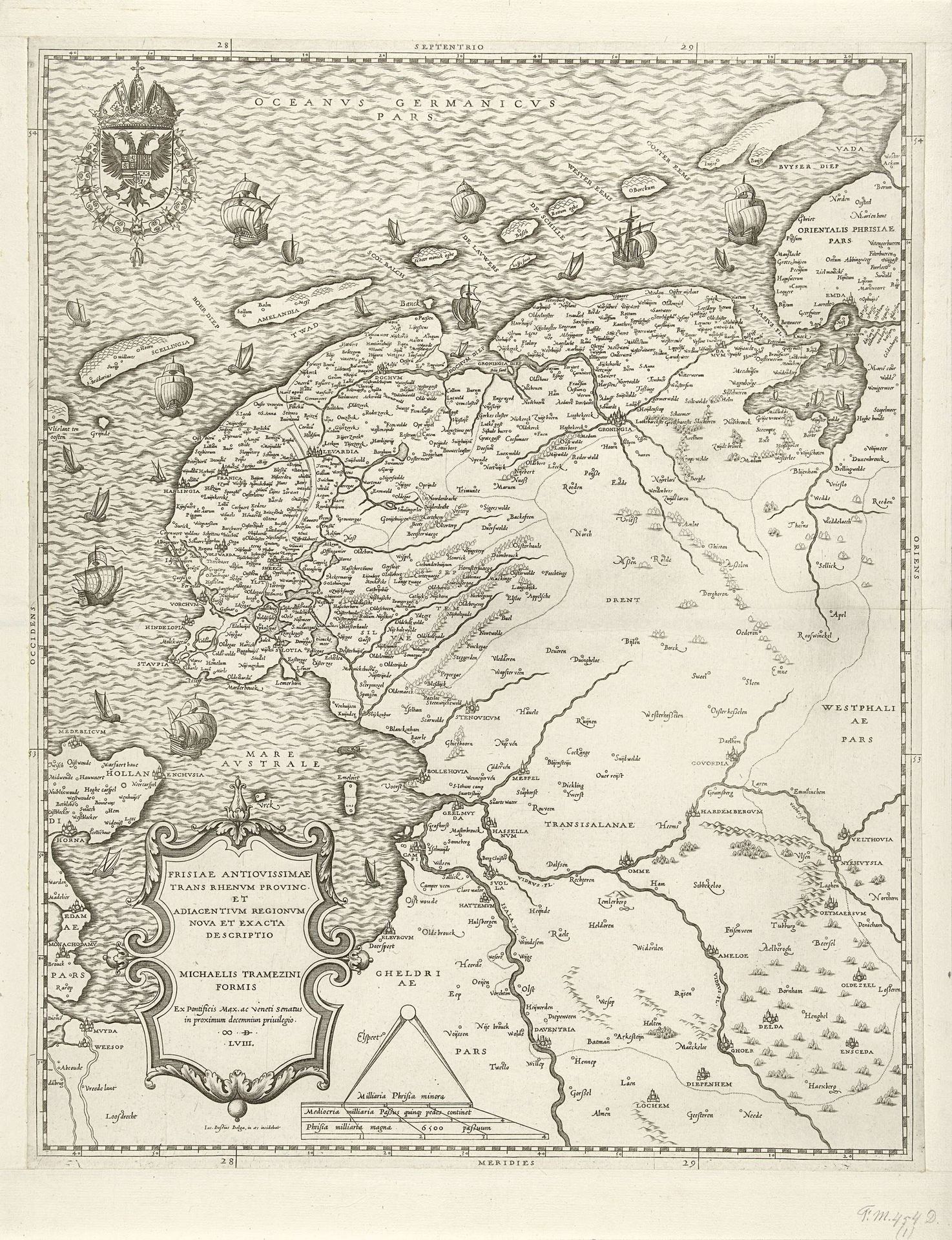
This map of Friesland, Groningen, Drenthe, and Overijssel was engraved by Jacob Bos around the mid-16th century, a period marked by significant cultural and political upheaval in the Netherlands. Bos, situated within the burgeoning printmaking industry, captured not just geographical data, but also the complex relationship between land, identity, and power. During this time, the Low Countries were a nexus of trade, religious reform, and nascent national consciousness, all of which deeply influenced the production and reception of cartography. Maps were far from neutral; they asserted territorial claims and projected cultural narratives. Bos's engraving intersects with issues of regional identity, as Friesland and its neighboring provinces struggled to define themselves amidst larger political entities. The map reflects an emotional investment in place, subtly asserting the distinctiveness and value of these regions during a time of immense change. It’s a testament to how deeply our sense of self is intertwined with the land we inhabit.
Artwork details
- Medium
- drawing, print, ink, pen, engraving
- Dimensions
- height 493 mm, width 393 mm
- Copyright
- Rijks Museum: Open Domain
Tags
Comments
Share your thoughts
About this artwork
This map of Friesland, Groningen, Drenthe, and Overijssel was engraved by Jacob Bos around the mid-16th century, a period marked by significant cultural and political upheaval in the Netherlands. Bos, situated within the burgeoning printmaking industry, captured not just geographical data, but also the complex relationship between land, identity, and power. During this time, the Low Countries were a nexus of trade, religious reform, and nascent national consciousness, all of which deeply influenced the production and reception of cartography. Maps were far from neutral; they asserted territorial claims and projected cultural narratives. Bos's engraving intersects with issues of regional identity, as Friesland and its neighboring provinces struggled to define themselves amidst larger political entities. The map reflects an emotional investment in place, subtly asserting the distinctiveness and value of these regions during a time of immense change. It’s a testament to how deeply our sense of self is intertwined with the land we inhabit.
Comments
Share your thoughts