drawing, print, ink, engraving
pen and ink
drawing
dutch-golden-age
landscape
ink
cityscape
engraving
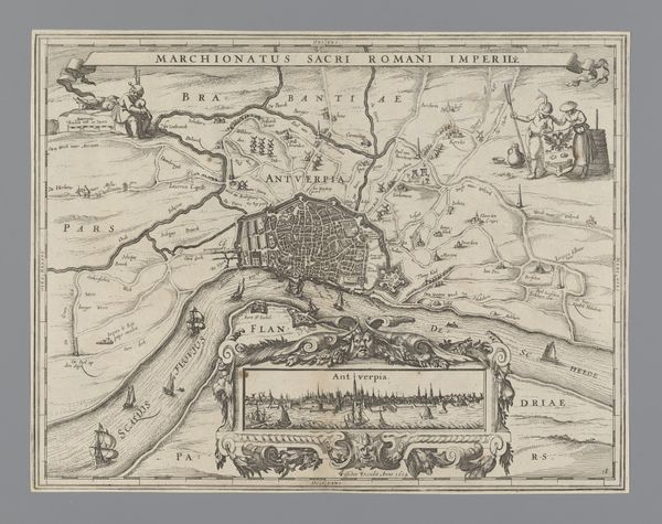
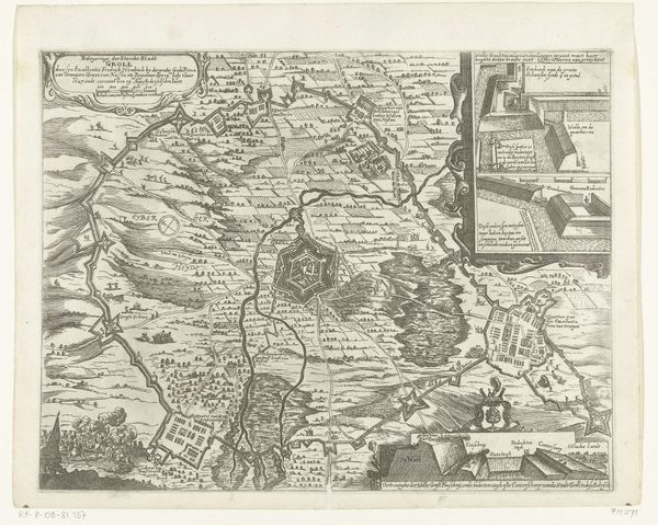
Dimensions: height 409 mm, width 544 mm
Copyright: Rijks Museum: Open Domain
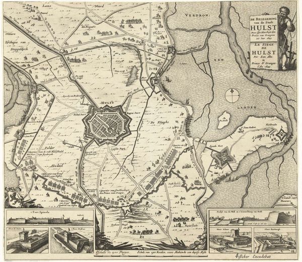
Editor: This engraving, "Inval van graaf Hendrik van den Bergh in de Veluwe, 1629", made by Claes Jansz. Visscher, is incredibly detailed! It’s like looking at a satellite image, only rendered in ink. The whole piece has a very strategic, almost cold feeling, doesn't it? How would you interpret this work? Curator: Indeed. While seemingly a landscape, it's crucial to understand the political and social function this image served. This wasn't merely an artistic rendering but a strategic visual tool. Consider the context: the Dutch Golden Age, a period of intense conflict and territorial disputes. Editor: So, more propaganda than art? Curator: Perhaps both. Images like these were often commissioned to communicate power and control. Notice the precision with which the territories are mapped, the implication being of a thorough and thus powerful grasp on the region. The Count's invasion becomes a visual claim of dominance, circulated through print. Editor: I see what you mean. It’s like the artist is declaring, "This is our land", in a very public and reproducible way. Is that why there's the extra close-up sections included? Curator: Exactly! The added detail reinforces the idea of knowing and controlling the territory, almost turning landscape into a political instrument. How do you think the common person at that time received it? Editor: Probably in awe, but also maybe with some trepidation about the constant warfare! Curator: Precisely. These images played a critical role in shaping public perception, turning warfare into something almost administrative, an act of claiming, of knowing a space intimately. Something to reflect upon given today's image-saturated culture as well. Editor: It’s interesting to see how art back then was very functional as well, shaping opinions, unlike just being aesthetic pieces now. Thanks!
Comments
No comments
Be the first to comment and join the conversation on the ultimate creative platform.