About this artwork
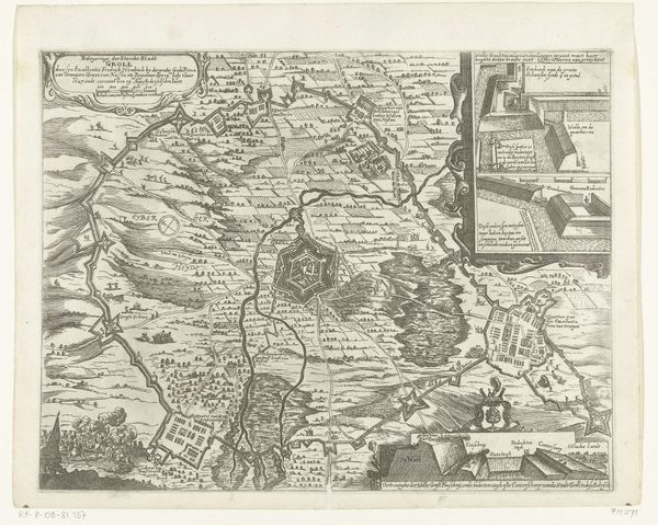
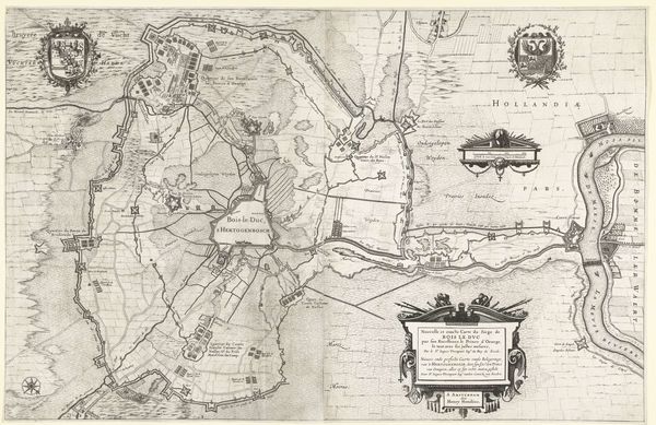
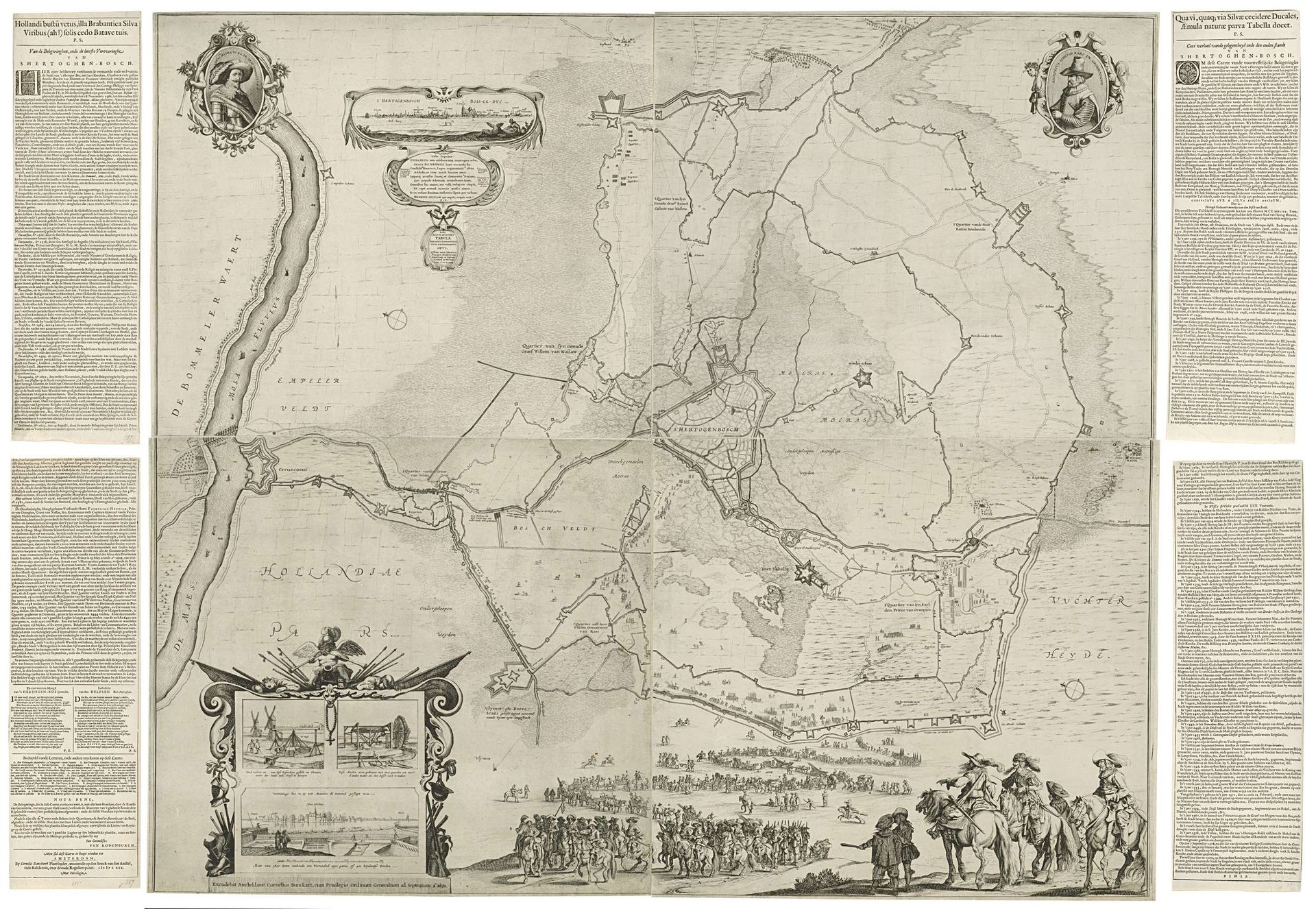
Cornelis Danckerts created this detailed map of the siege and capture of Den Bosch by Frederik Hendrik in 1629. The map is filled with symbolic representations of power and authority. Note the prominent display of heraldic symbols and allegorical figures in the upper corners. These are not mere decorations; they are potent emblems of sovereignty and legitimacy. Observe how Danckerts employs cartographic symbols to convey not just geographical data but also a narrative of triumph and dominance. This harks back to ancient Roman cartography, where maps were instruments of imperial power, visually asserting control over vast territories. Consider the evolution of the laurel wreath, a classical symbol of victory. Here, it crowns the images, yet its roots lie in ancient Greece, awarded to athletic champions and poets. Over time, this symbol migrated into military and political spheres, signifying triumph and honor. Note the psychological weight of such symbols; they tap into deep-seated collective memories of glory and achievement. The strategic placement of these icons is no accident. They are designed to evoke feelings of pride and reverence, reinforcing the psychological impact of the depicted victory on the viewer. This map is not just a record, but a carefully constructed statement of power and enduring legacy.
Grote kaart met beleg en inname van Den Bosch door Frederik Hendrik, 1629
1630
Cornelis (I) Danckerts
1604 - 1656Location
RijksmuseumArtwork details
- Medium
- drawing, print, ink, engraving
- Dimensions
- height 1100 mm, width 1130 mm
- Location
- Rijksmuseum
- Copyright
- Rijks Museum: Open Domain
Tags
Comments
Share your thoughts
About this artwork
Cornelis Danckerts created this detailed map of the siege and capture of Den Bosch by Frederik Hendrik in 1629. The map is filled with symbolic representations of power and authority. Note the prominent display of heraldic symbols and allegorical figures in the upper corners. These are not mere decorations; they are potent emblems of sovereignty and legitimacy. Observe how Danckerts employs cartographic symbols to convey not just geographical data but also a narrative of triumph and dominance. This harks back to ancient Roman cartography, where maps were instruments of imperial power, visually asserting control over vast territories. Consider the evolution of the laurel wreath, a classical symbol of victory. Here, it crowns the images, yet its roots lie in ancient Greece, awarded to athletic champions and poets. Over time, this symbol migrated into military and political spheres, signifying triumph and honor. Note the psychological weight of such symbols; they tap into deep-seated collective memories of glory and achievement. The strategic placement of these icons is no accident. They are designed to evoke feelings of pride and reverence, reinforcing the psychological impact of the depicted victory on the viewer. This map is not just a record, but a carefully constructed statement of power and enduring legacy.
Comments
Share your thoughts