About this artwork
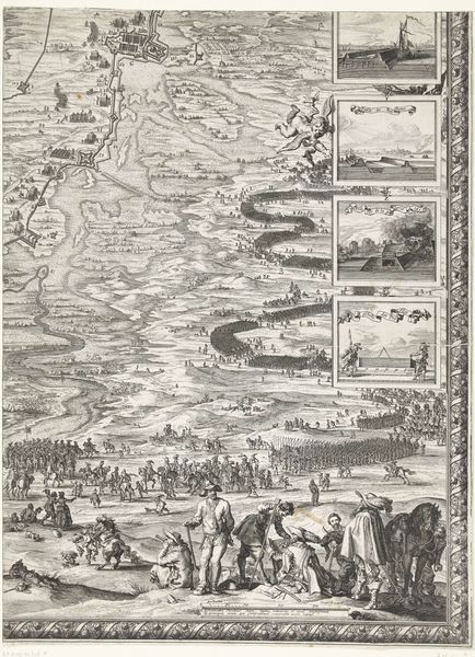
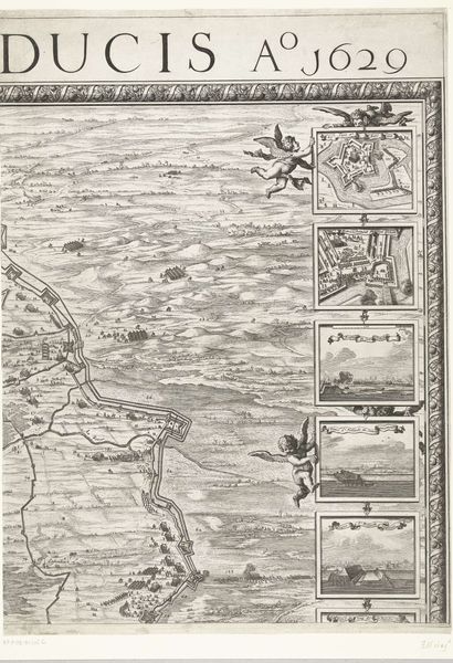
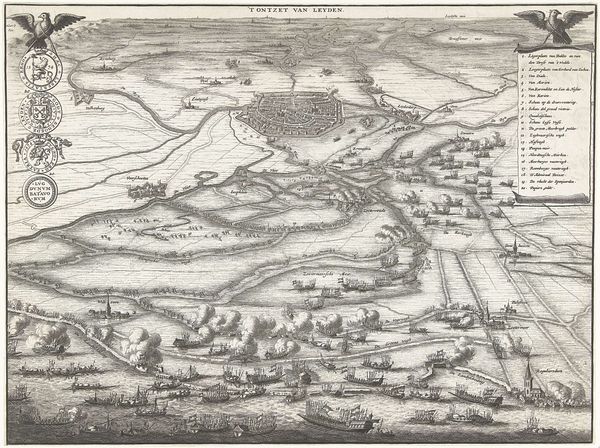
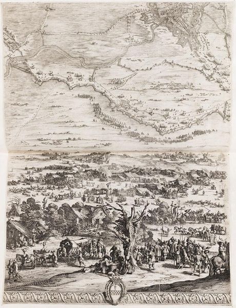
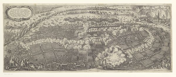
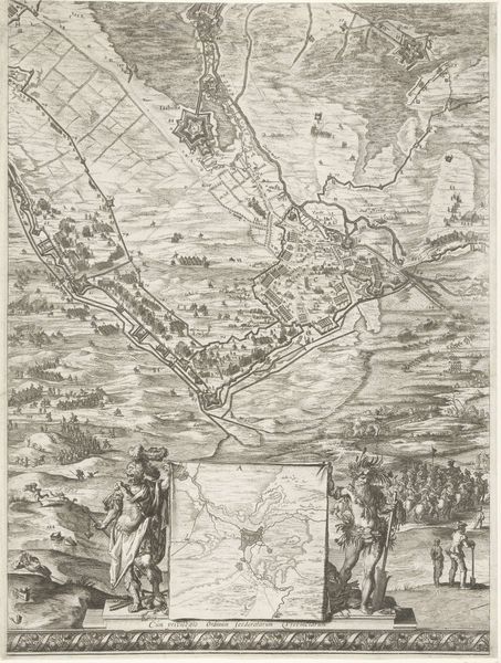
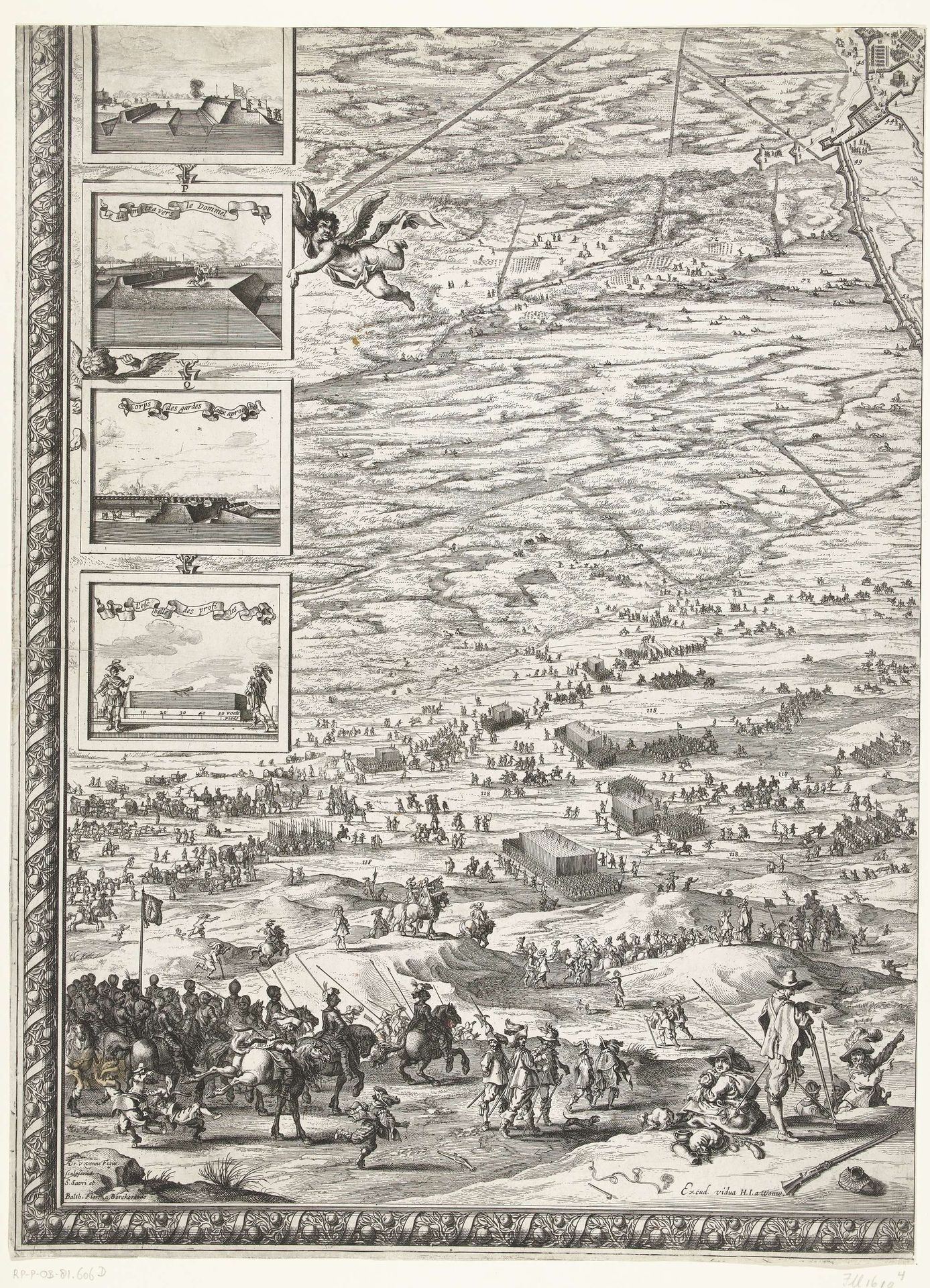
This is a section of a map, made in 1629 by Salomon Savery, depicting Frederik Hendrik’s siege of Den Bosch. It’s made using engraving, a printmaking technique where lines are incised into a metal plate, which is then inked and printed. The material qualities of the print are striking: the fine, precise lines delineate the layout of the siege with remarkable clarity. The technique allowed for mass production of these maps, turning information into a commodity and fueling public interest in military campaigns. Look closely, and you’ll notice the incredible detail: from the fortifications to the tiny figures of soldiers and civilians. The repetitive action of incising each line speaks to the immense labor involved in creating such a detailed image. The print testifies to the intersection of art, craft, and commerce in the 17th century. By appreciating the material and the making, we recognize the role of printmaking in shaping public opinion and historical narratives.
Grote kaart van het beleg van Den Bosch door Frederik Hendrik (blad linksonder), 1629
1629
Salomon Savery
1594 - 1678Location
RijksmuseumArtwork details
- Medium
- drawing, print, ink, engraving
- Dimensions
- height 630 mm, width 465 mm
- Location
- Rijksmuseum
- Copyright
- Rijks Museum: Open Domain
Tags
Comments
Share your thoughts
About this artwork
This is a section of a map, made in 1629 by Salomon Savery, depicting Frederik Hendrik’s siege of Den Bosch. It’s made using engraving, a printmaking technique where lines are incised into a metal plate, which is then inked and printed. The material qualities of the print are striking: the fine, precise lines delineate the layout of the siege with remarkable clarity. The technique allowed for mass production of these maps, turning information into a commodity and fueling public interest in military campaigns. Look closely, and you’ll notice the incredible detail: from the fortifications to the tiny figures of soldiers and civilians. The repetitive action of incising each line speaks to the immense labor involved in creating such a detailed image. The print testifies to the intersection of art, craft, and commerce in the 17th century. By appreciating the material and the making, we recognize the role of printmaking in shaping public opinion and historical narratives.
Comments
Share your thoughts