drawing, ink
#
drawing
#
baroque
#
ink
#
geometric
#
cityscape
Dimensions: height 382 mm, width 490 mm
Copyright: Rijks Museum: Open Domain
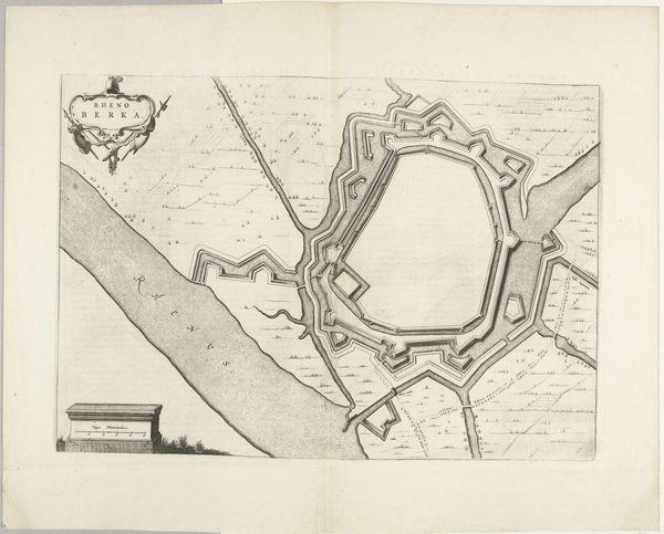
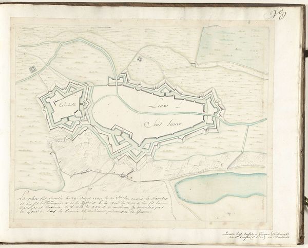
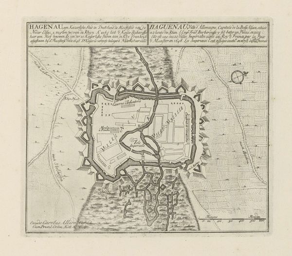
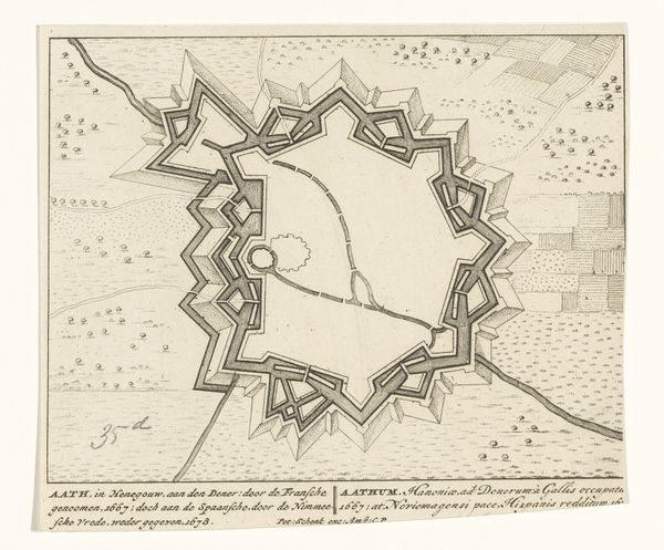
Samuel Du Ry de Champdoré's plan of Kortrijk, made around 1701 to 1715, presents the city as a fortified space, bordered by walls and a river. These aren’t just architectural elements, but powerful symbols of protection, of civilization against the unknown, untamed wilderness, and potential enemies. This motif of enclosure echoes through history. Think of the walled cities of antiquity, such as the massive walls surrounding ancient Babylon, or even the protective hedges in medieval tapestries; all are emblems of security and order in a chaotic world. The zig-zagging fortifications around Kortrijk evoke a sense of defensive strength, almost like the teeth of a predator, guarding its territory. Psychologically, these borders represent the human desire for safety and control, a defense against existential fears. Over time, these symbols have evolved, but the underlying need for protection remains, manifesting in our art, architecture, and even our personal spaces. This cartographic plan is not merely a record of a city, but a projection of our deepest anxieties and aspirations.
Comments
No comments
Be the first to comment and join the conversation on the ultimate creative platform.
More like this