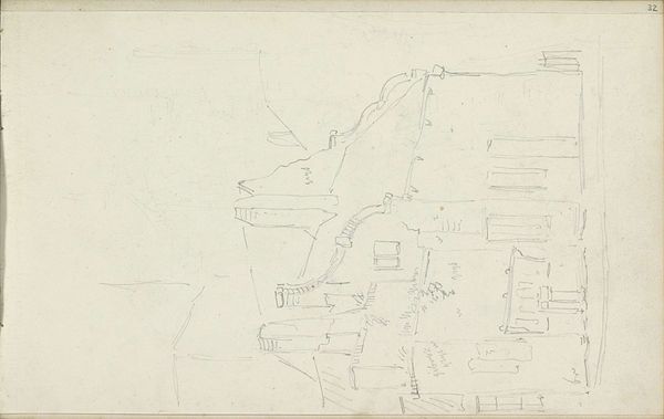
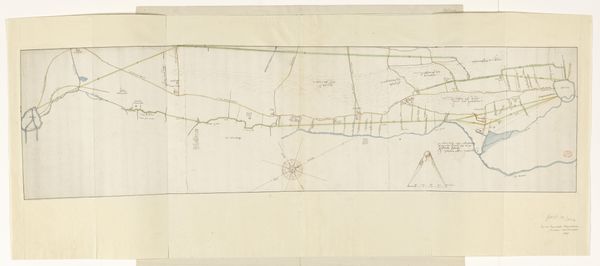
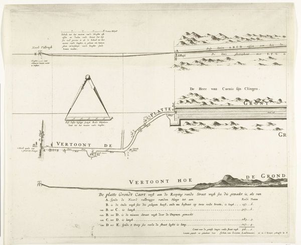
Map of the Southern part of the Cape from St Helena Bay to the Great Fish River c. 1777s
0:00
0:00
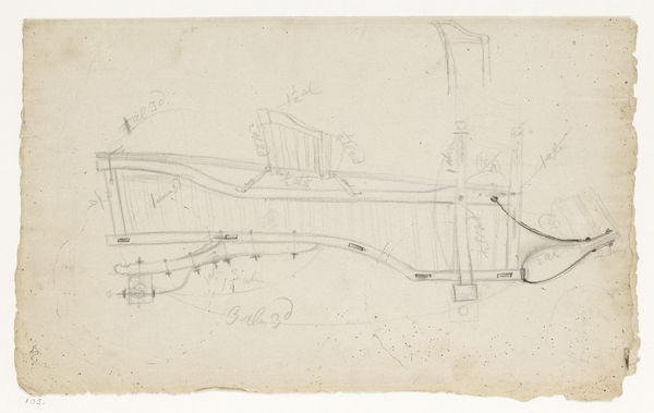
drawing, paper, ink
#
drawing
#
landscape
#
etching
#
paper
#
ink
Dimensions: height 770 mm, width 1490 mm
Copyright: Rijks Museum: Open Domain
Editor: Here we have Robert Jacob Gordon's "Map of the Southern part of the Cape from St Helena Bay to the Great Fish River," made around 1777, using ink on paper. The intricacy is fascinating, the detail layered so skillfully on top of the map’s grid structure. What aspects of the drawing stand out to you the most? Curator: The most immediate aspect is the drawing’s delicate balance between representation and abstraction. Note the almost mathematical precision of the grid underlying the organic forms of the landscape. Editor: Right, there's something quite striking in how these geometrical elements and naturalistic forms come together. Curator: Indeed. Observe how the flowing lines delineate coastal features with surprising accuracy, whilst the texture of the land, and annotations, appear as formal abstractions within the greater composition. Gordon's work occupies a liminal space between science and art. The lettering is another point of focus - calligraphic quality providing a certain visual harmony. Editor: You are correct, the integration of text really stands out within the composition. Do you consider its presence purely informational? Curator: Not exclusively. Though practical in purpose, observe how the varying sizes and weights of the fonts contribute to a complex interplay of visual rhythm, shaping our gaze, as they simultaneously point out various elements of the overall representation. A crucial detail, wouldn’t you agree? Editor: Absolutely! I had only seen this as an old map, but focusing on the relationship between all these elements brings out an aesthetic side that I totally missed before. Curator: Precisely. Considering these design decisions provides insight not only into Gordon's formal intentions but the larger relationship between aesthetics, knowledge and power at the time. Editor: This has completely transformed how I appreciate this piece! Thanks so much.
Comments
No comments
Be the first to comment and join the conversation on the ultimate creative platform.
More like this