print, engraving
#
baroque
# print
#
landscape
#
geometric
#
cityscape
#
history-painting
#
engraving
Dimensions: height 339 mm, width 402 mm
Copyright: Rijks Museum: Open Domain
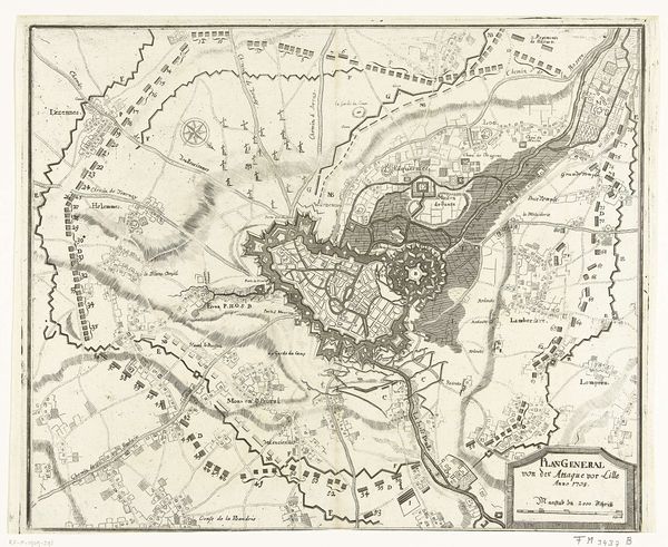
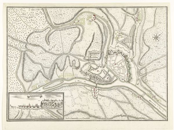
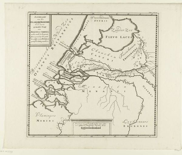
This 1706 map illustrates the siege of Menen, presenting a visual language steeped in the iconography of military conflict. Lines of fortification, strategic placements of troops, and the natural barriers of rivers are laid out with the precision of a rational plan, yet they evoke a sense of inevitable confrontation. Consider the act of mapping itself: from ancient Roman cadastres to Renaissance portolan charts, maps are not merely representations of space. They are assertions of power, strategies for control, and projections of human will onto the landscape. Notice how each element is not just a geographical marker but also a psychological one, influencing our perception of space and strategy. The river, depicted as both a lifeline and an obstacle, mirrors the psychoanalytic concept of a symbolic boundary, representing the threshold between the known and the unknown, the safe and the dangerous. The image of Menen transforms from a mere depiction of a siege into an archetypal expression of human conflict. It reminds us that, like the ever-changing flow of the river, human conflicts resurface in different guises.
Comments
No comments
Be the first to comment and join the conversation on the ultimate creative platform.
More like this