drawing, paper, ink, engraving
drawing
aged paper
toned paper
baroque
ink paper printed
old engraving style
paper
personal sketchbook
ink
pen-ink sketch
ink colored
pen work
sketchbook drawing
cityscape
sketchbook art
engraving
Dimensions: height 128 mm, width 133 mm
Copyright: Rijks Museum: Open Domain
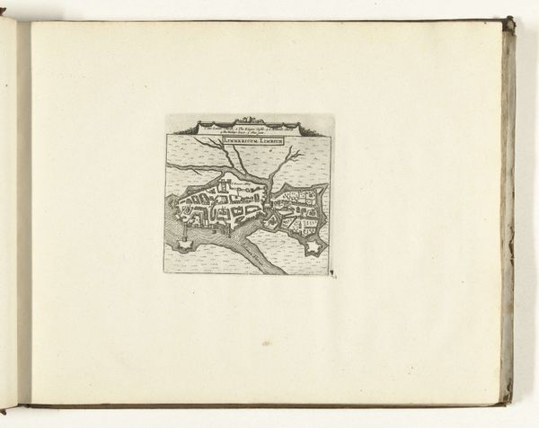
This is an anonymous, small, unassuming map made in 1726 that pictures Galway. But, the scale belies the fraught history of a place that was once one of Ireland’s most important port cities, and a nexus of trade between Ireland and Europe. Maps are never neutral, but are always an assertion of power. Here, the very act of mapping Galway speaks to the increasing control exerted by the British Empire, who sought to chart and thus claim authority over the city. Yet, Galway also represents a site of cultural exchange and resistance. The city was home to a unique blend of Irish and European influences, a place where Gaelic traditions intertwined with continental culture, and where powerful merchant families maintained close ties with Spain and France. Looking at this map, I think about how it flattens a lived, and complex reality into a set of lines, erasing the nuances of identity, culture, and resistance. The emotional weight of such erasures, and what they represent for the people whose histories are bound to the city cannot be overstated.
Comments
No comments
Be the first to comment and join the conversation on the ultimate creative platform.