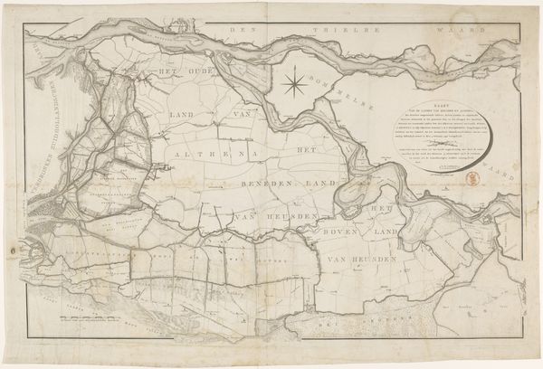
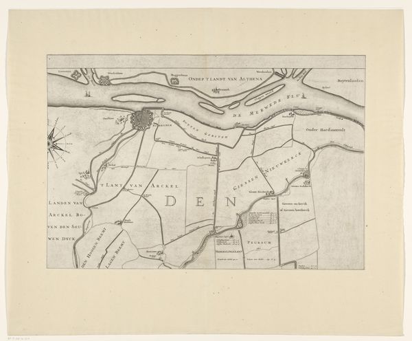
Kaart van het gebied tussen Den Bosch en Geertruidenberg met dijkdoorbraken (vierde blad) before 1757
0:00
0:00
print, engraving
#
ink paper printed
# print
#
old engraving style
#
landscape
#
geometric
#
cityscape
#
engraving
#
regionalism
Dimensions: height 299 mm, width 464 mm
Copyright: Rijks Museum: Open Domain
This map depicts the area between Den Bosch and Geertruidenberg, highlighting dike breaches through stark lines. These are not merely geographical markings. Water, throughout history, is a powerful symbol, a force of destruction but also of purification. I am reminded of the Great Flood in ancient Mesopotamian art where water is chaos, a divine punishment. The map's breaches are like wounds upon the land, mirroring the emotional scars left by such disasters on the collective psyche. These breaches echo in the Deluge scenes painted by artists throughout the ages. Just as the artists of the Renaissance imbued their works with classical motifs, so too does this map subtly invoke a primal fear. We are reminded of our vulnerability to the natural world, a fear that is both personal and deeply rooted in our shared past. It is a reminder of the cyclical nature of history.
Comments
No comments
Be the first to comment and join the conversation on the ultimate creative platform.
More like this