About this artwork
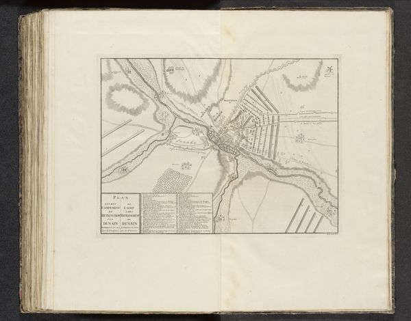
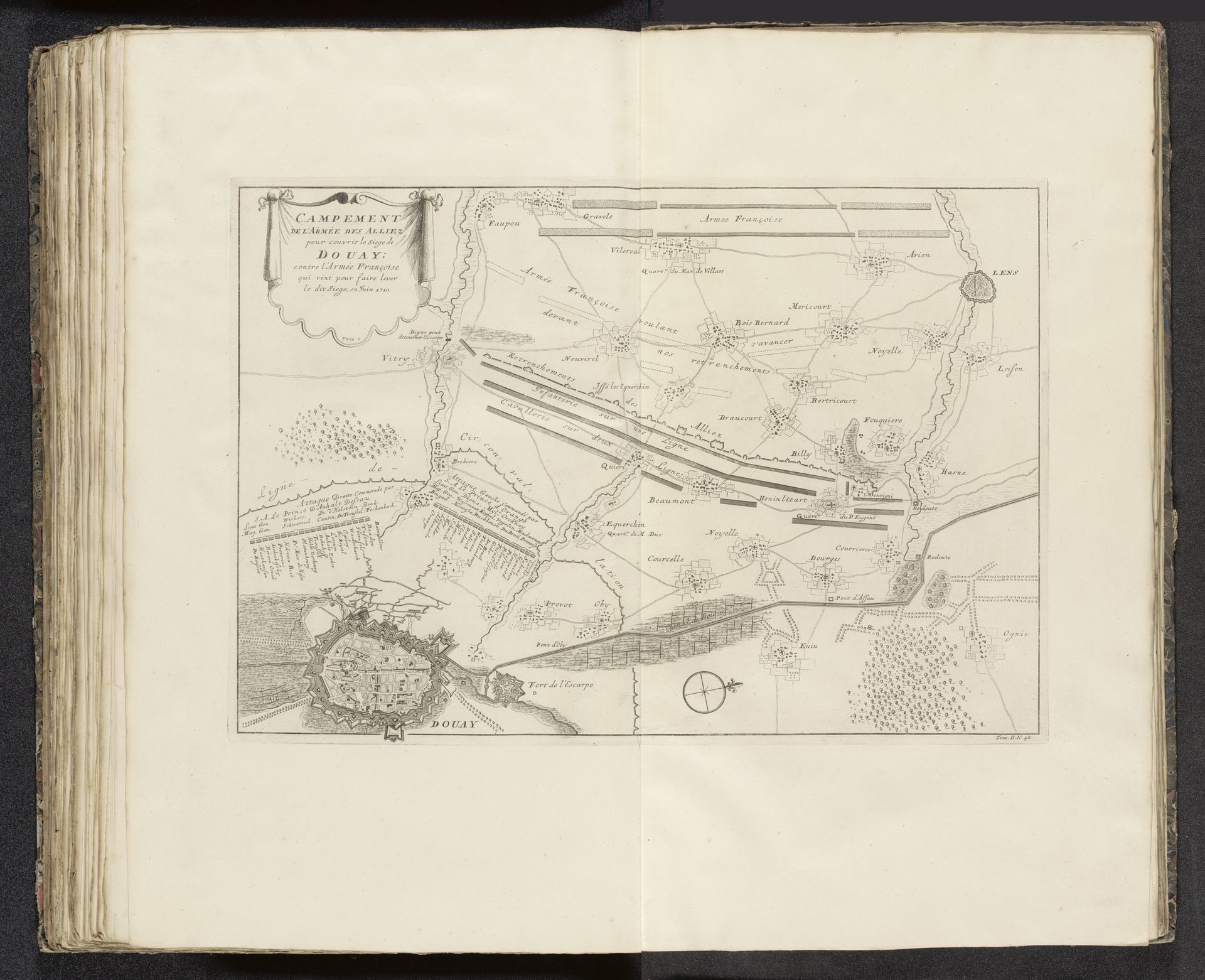
Pieter van Call the Younger created this drawing, "Legerkamp van de Geallieerden bij het beleg van Douai, 1710," using pen and ink. Its detailed bird's-eye view invites us to explore the structured layout of a military encampment. The linear precision in van Call's drawing delineates space and strategy with remarkable clarity. Note the stark contrast between the dense, almost chaotic depiction of Douai and the ordered lines of the allied forces. This juxtaposition isn't just geographical, but also a statement about control and order versus the unpredictable nature of siege warfare. The compass rose at the bottom isn't merely functional; it's a symbolic gesture toward understanding and navigating the complexities of conflict. Van Call uses his medium to create not just a map, but a meditation on the structures of power and knowledge in the theater of war. The artwork presents a vision of how the abstract precision of cartography can serve the concrete aims of military strategy.
Legerkamp van de Geallieerden bij het beleg van Douai, 1710 1710s - 1720s
Pieter van (II) Call
1688 - 1737Location
RijksmuseumArtwork details
- Medium
- drawing, paper, ink, engraving
- Dimensions
- height 349 mm, width 495 mm
- Location
- Rijksmuseum
- Copyright
- Rijks Museum: Open Domain
Tags
drawing
aged paper
toned paper
baroque
sketch book
landscape
paper
personal sketchbook
ink
ink drawing experimentation
geometric
pen-ink sketch
pen work
sketchbook drawing
cityscape
history-painting
storyboard and sketchbook work
sketchbook art
engraving
Comments
No comments
About this artwork
Pieter van Call the Younger created this drawing, "Legerkamp van de Geallieerden bij het beleg van Douai, 1710," using pen and ink. Its detailed bird's-eye view invites us to explore the structured layout of a military encampment. The linear precision in van Call's drawing delineates space and strategy with remarkable clarity. Note the stark contrast between the dense, almost chaotic depiction of Douai and the ordered lines of the allied forces. This juxtaposition isn't just geographical, but also a statement about control and order versus the unpredictable nature of siege warfare. The compass rose at the bottom isn't merely functional; it's a symbolic gesture toward understanding and navigating the complexities of conflict. Van Call uses his medium to create not just a map, but a meditation on the structures of power and knowledge in the theater of war. The artwork presents a vision of how the abstract precision of cartography can serve the concrete aims of military strategy.
Comments
No comments