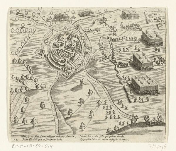
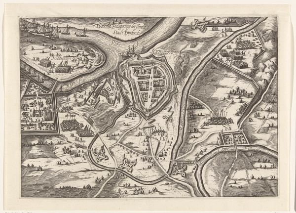
print, engraving
#
baroque
# print
#
perspective
#
cityscape
#
history-painting
#
engraving
Dimensions: height 150 mm, width 238 mm
Copyright: Rijks Museum: Open Domain
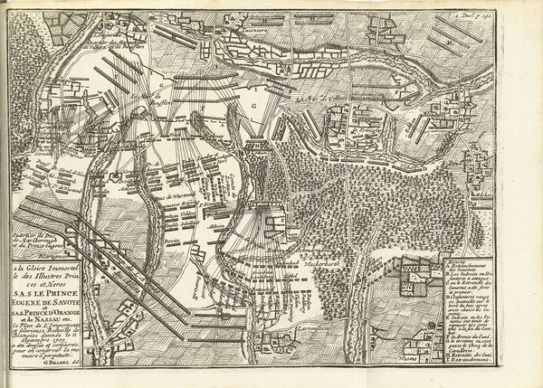
Curator: I find myself immediately drawn into the meticulous detail of this engraving, which, upon closer inspection, unveils a siege! The fine lines and methodical approach really give you an idea of how the artist built it up. Editor: A siege, yes! The "Beleg van Keizersweerd, 1702", made by Matthijs Pool in 1716, immortalizes a brutal moment in the Nine Years' War, part of those constant power struggles throughout Europe. You can almost feel the weight of history pressing down on you. Curator: Pool was clearly skilled, achieving a remarkable level of precision. You can almost imagine the back and forth required, layering image, ink, and pressure with expert attention to the copper plate. Consider that material cost as well! What about the economy of images during this period? Editor: Precisely! Let's think about Keizersweerd itself. This wasn't just any town; it was strategically important, a key point of access. Maps weren't just neutral records—they were instruments of power, asserting claims and directing military campaigns. Curator: And consider the distribution network required for these prints. They had to consider paper quality, ink source, the number of prints necessary to distribute amongst leaders and inform public perception of the war. All of that influences the overall composition we see today. Editor: Indeed, what looks like an objective overview is really shaped by a very particular political lens, and, as always, what gets included, and what's purposefully left out! How were the experiences of ordinary soldiers, or civilians caught in the crossfire, represented or ignored? Curator: The print acts as an artifact of this historical power dynamic as much as any weapon brandished in the actual conflict, I'd say. How were those at the lower rungs of military infrastructure being employed? These kinds of large projects always require logistical support, and careful labor management. Editor: Exactly. So, as we admire the detail, we should also think critically about what it chooses to show us—and what it silently conceals. Art always carries inherent assumptions of its creation, access, and overall impact. Curator: I completely agree. What starts as admiration for skill quickly shifts to considering production methods and embedded value judgements! Editor: Well, I am grateful for both! And I hope the visitors will start to consider some of these questions themselves.
Comments
No comments
Be the first to comment and join the conversation on the ultimate creative platform.
More like this