drawing, print, ink, engraving
#
drawing
#
baroque
# print
#
ink line art
#
ink
#
geometric
#
cityscape
#
history-painting
#
engraving
Dimensions: height 392 mm, width 461 mm
Copyright: Rijks Museum: Open Domain
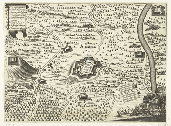
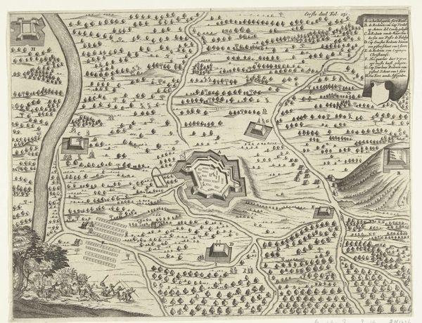
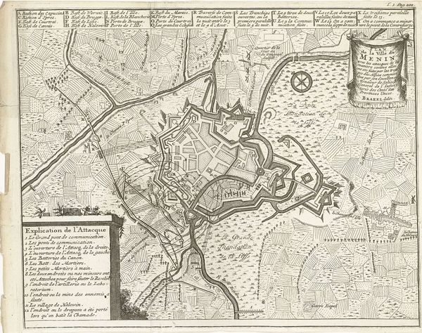
This anonymous plan of the siege of Tournai, created in 1709, meticulously maps the city and its fortifications. Notice the prominent star-shaped citadel, a motif extending far beyond military diagrams. The star fort design, with its bastions and angled walls, can be traced back to Italian Renaissance fortress design, drawing from early medieval castles. The star motif, often seen in religious and mystical art, here symbolizes defense and power, yet, ironically, also vulnerability under siege. Consider how stars appear in ancient cosmologies, representing celestial order, now refigured in earthly conflict. Such forms resonate with a deep human impulse to impose order and protection, echoing through centuries in both sacred and secular contexts. This image stirs a contemplation on the cyclical nature of human ambition and the enduring symbols that reflect our deepest fears and aspirations.
Comments
No comments
Be the first to comment and join the conversation on the ultimate creative platform.
More like this