drawing, print, paper, ink, engraving
#
drawing
#
dutch-golden-age
# print
#
paper
#
ink
#
geometric
#
line
#
cityscape
#
engraving
Dimensions: height 180 mm, width 268 mm
Copyright: Rijks Museum: Open Domain
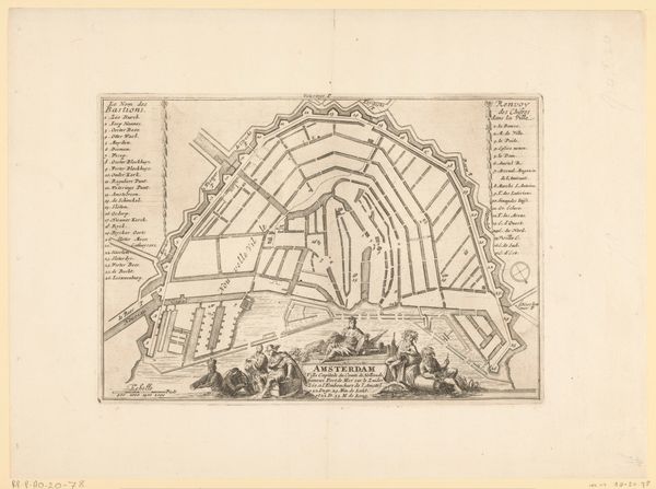
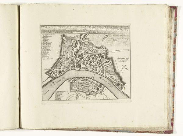
This is an anonymous map of Amsterdam, made around 1702, from ink on paper. The material is simple, but the effect is not. Paper was relatively precious back then, and the ink would have been carefully formulated. The image was created by engraving a metal plate, inking it, and then using a press to transfer the image to the page. It was a skilled, labor-intensive process. Look closely, and you'll see that the city is laid out with incredible precision. Each street, canal, and building is carefully rendered. The map isn't just a representation of Amsterdam. It's a symbol of Dutch power and ingenuity. The creation of the map reflects a culture deeply invested in trade and commerce. Accuracy was paramount, and this little print represents countless hours of labor and expertise. The importance of this map lies not only in its artistic execution, but also in its reflection of the historical and social context of the Dutch Golden Age. It challenges us to look beyond the surface and consider the deeper meanings embedded in the material and the making.
Comments
No comments
Be the first to comment and join the conversation on the ultimate creative platform.
More like this