About this artwork
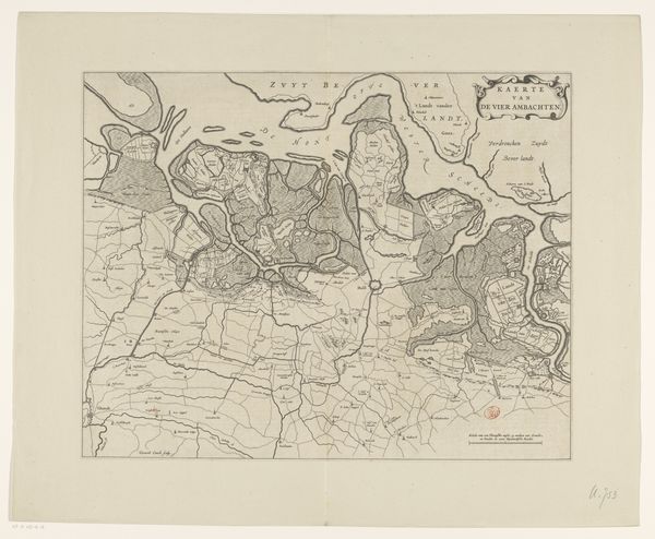
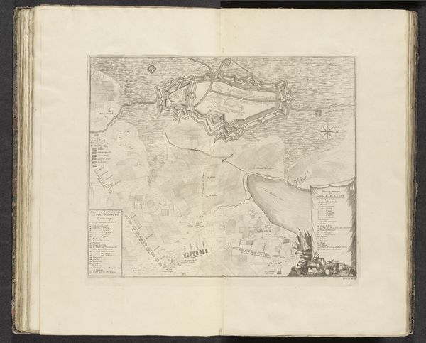
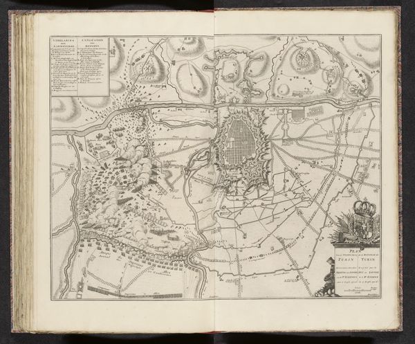
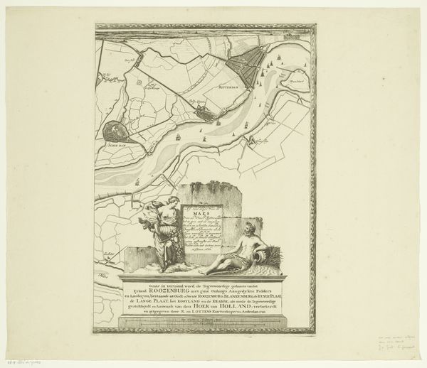
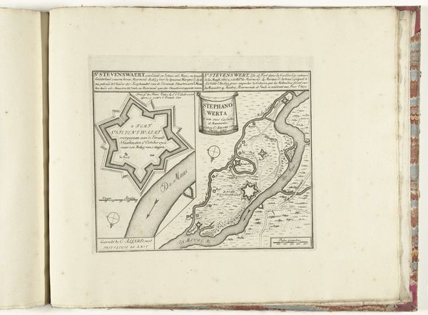
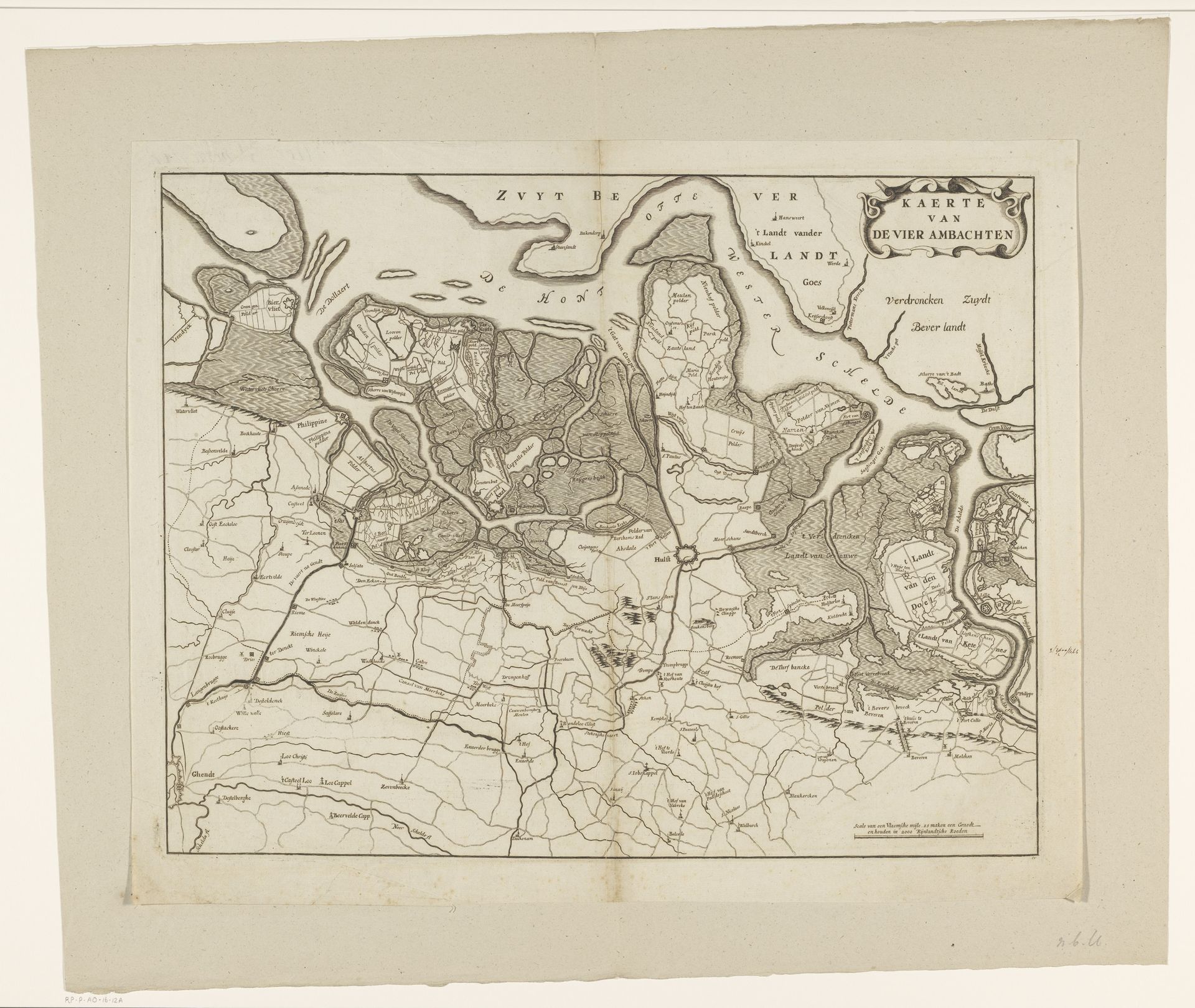
This map of the Vier Ambachten was made by Gerard Coeck in the 17th century. It’s an etching, meaning that the lines you see were incised into a metal plate, probably copper, using a sharp needle-like tool. The plate would then have been inked and printed onto paper. Maps like this were more than just geographical documents. They were also products of intense labour and skill. Surveying the land, engraving the plate, and printing the final image all required precise techniques. The act of mapping itself could be a form of control, defining boundaries and asserting ownership. Look closely and you can see the detailed lines that define the landscape: fields, waterways, and settlements. Each mark represents countless hours of work, both in the physical landscape and in the artist's studio. By considering the materials, making, and context, we can appreciate this map not just as a representation of space, but as a testament to the labor, politics, and knowledge of its time.
Artwork details
- Medium
- print, engraving
- Dimensions
- height 416 mm, width 528 mm
- Copyright
- Rijks Museum: Open Domain
Tags
Comments
Share your thoughts
About this artwork
This map of the Vier Ambachten was made by Gerard Coeck in the 17th century. It’s an etching, meaning that the lines you see were incised into a metal plate, probably copper, using a sharp needle-like tool. The plate would then have been inked and printed onto paper. Maps like this were more than just geographical documents. They were also products of intense labour and skill. Surveying the land, engraving the plate, and printing the final image all required precise techniques. The act of mapping itself could be a form of control, defining boundaries and asserting ownership. Look closely and you can see the detailed lines that define the landscape: fields, waterways, and settlements. Each mark represents countless hours of work, both in the physical landscape and in the artist's studio. By considering the materials, making, and context, we can appreciate this map not just as a representation of space, but as a testament to the labor, politics, and knowledge of its time.
Comments
Share your thoughts