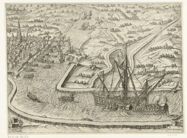
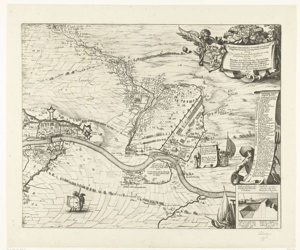
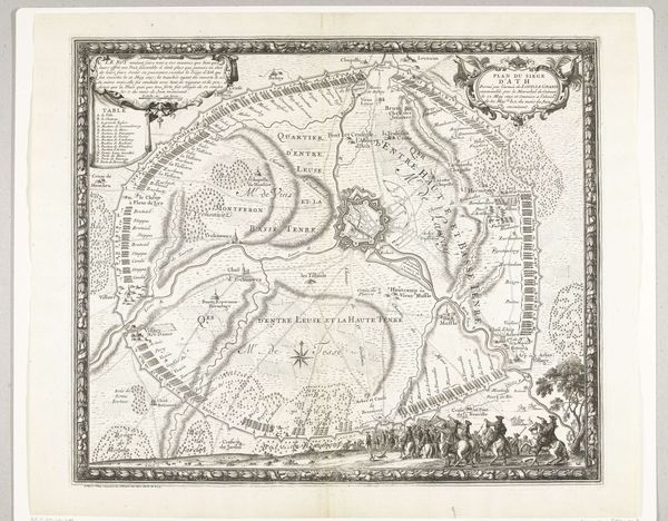
Kaart met de posities van de geallieerde en de Franse troepen West-Vlaanderen in juni en juli 1695. 1695
0:00
0:00
gilliamvandergouwen
Rijksmuseum
drawing, print, ink, engraving
#
drawing
#
baroque
#
pen drawing
# print
#
ink
#
geometric
#
cityscape
#
history-painting
#
engraving
Dimensions: height 505 mm, width 605 mm
Copyright: Rijks Museum: Open Domain
Editor: So, this detailed map, “Kaart met de posities van de geallieerde en de Franse troepen West-Vlaanderen in juni en juli 1695,” created in 1695 by Gilliam van der Gouwen, seems to depict troop positions using ink, print, and engraving. It feels very formal, almost like a strategic game laid out on paper. What are some of the symbols and images that strike you when you look at this work? Curator: The most striking symbol here is the map itself. Maps aren't just representations of terrain; they're assertions of power, control, and knowledge. In this period, maps are frequently visual arguments intended to persuade rather than simply document. Notice how the allied forces and French troops are rendered: the details aren’t just topographical but filled with implied military might. Look at the allegorical figures in the top and bottom corners – who do they represent, and what do they signify in the context of the military campaign? Editor: I see a classical female figure and a warrior. Is it about justification of military campaigns through the symbolism of historical memory and victory? Curator: Precisely. The warrior could evoke Mars, the god of war, while the female figure might be an allegory of victory or even a personified West Flanders. These symbols connect the specific battle depicted to larger cultural narratives of heroism, conquest, and rightful dominion. How do those symbols alter our understanding of what the map ‘means’? Is it objective reporting, or something more loaded? Editor: I hadn't considered that; the map felt so technical, I missed the propaganda element. It makes me rethink how historical events get framed visually. Curator: Indeed. These weren't merely informative pieces but carefully constructed narratives employing familiar symbolic language to shape public perception and cement legacies. This piece demonstrates a very particular manipulation of imagery for cultural endurance and collective memory. Editor: Thanks, I learned to think about maps more critically.
Comments
No comments
Be the first to comment and join the conversation on the ultimate creative platform.
More like this