print, paper, engraving
#
dutch-golden-age
# print
#
old engraving style
#
landscape
#
paper
#
line
#
cityscape
#
history-painting
#
engraving
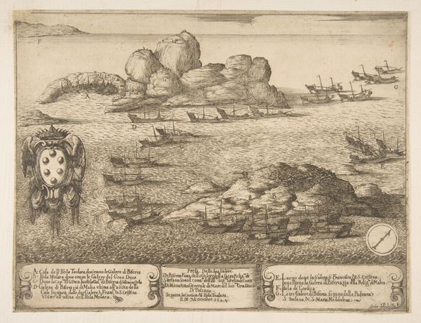
Dimensions: height 145 mm, width 220 mm
Copyright: Rijks Museum: Open Domain
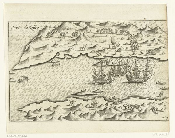
Editor: This is an old engraving, "Kaart van Sint-Helena, 1597," printed on paper by an anonymous artist. It's fascinating, this almost clinical depiction of an island surrounded by ships, but the detail also makes it feel quite…distant. What's your take? Curator: It's critical to understand that maps of this era were rarely neutral depictions of geography. How do you interpret the positioning of the ships around St. Helena? Editor: They seem to be guarding it, maybe? Or surveying the land? Curator: Precisely! Consider St. Helena's location, a strategic point for maritime powers like the Dutch Republic. This "Kaart," then, becomes an assertion of power and control. Whose power do you imagine it is? Editor: Presumably the Dutch Republic since the artwork is in the Rijksmuseum collection and it’s listed as Dutch Golden Age style. So the map served as visual propaganda. Curator: Absolutely. And more subtly, note the detailed rendering of the ships versus the island itself. What does this visual emphasis suggest to you about the priorities of the mapmaker, and perhaps, the society he represented? Editor: That’s interesting…the ships are more meticulously drawn than the island. It puts trade and naval power front and center, with less focus on the land and people themselves. This speaks volumes about colonial ambitions. Curator: Precisely. We often view historical artworks through an aesthetic lens, but works like this "Kaart" offer vital insights into the political and economic power structures of their time. What do you think of that? Editor: I'll definitely look at maps differently now! I hadn’t considered how much power dynamics are embedded in something as seemingly objective as a map. Curator: Indeed, seeing art as an active agent in history truly changes how we understand our world.
Comments
No comments
Be the first to comment and join the conversation on the ultimate creative platform.
More like this