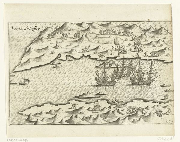
Kaarten van de eilanden Makian en Bacan in de Molukken, 1616 1617 - 1646
0:00
0:00
anonymous
Rijksmuseum
print, engraving
# print
#
pen sketch
#
old engraving style
#
landscape
#
geometric
#
line
#
cityscape
#
islamic-art
#
history-painting
#
engraving
Dimensions: height 150 mm, width 215 mm
Copyright: Rijks Museum: Open Domain
This 1616 map, created by an anonymous artist, depicts the islands of Makian and Bacan in the Moluccas. At first glance, the copperplate engraving presents a structured layout, divided into distinct sections, each offering a different perspective of the islands. The islands, rendered with meticulous detail, are contrasted by the stark lines and geometric precision of the settlement. Here, the artist uses a semiotic system, employing visual signs that not only represent physical space, but also delineate power structures and colonial claims. The map challenges our understanding of space as a neutral entity, revealing it instead as a field of encoded meanings and cultural narratives. Consider the formal composition—how the artist juxtaposes organic forms with geometric ones, inviting us to decode the complex relationship between nature and human intervention. In this map, form functions not merely as aesthetic, but as an integral part of a broader cultural and philosophical discourse on colonialism and representation.
Comments
No comments
Be the first to comment and join the conversation on the ultimate creative platform.
More like this