print, engraving, architecture
#
baroque
# print
#
cityscape
#
history-painting
#
engraving
#
architecture
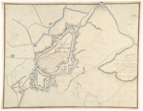
Dimensions: height 680 mm, width 535 mm
Copyright: Rijks Museum: Open Domain
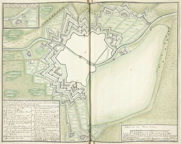
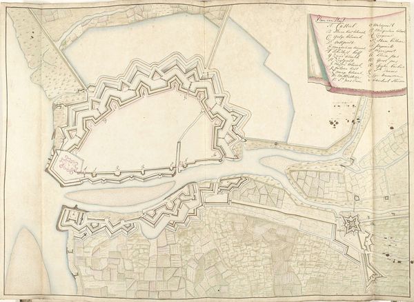
Editor: This is “Plattegrond van het kasteel van Edinburgh, 1692,” an engraving by Samuel Du Ry de Champdoré from 1692. It’s a fascinating bird's-eye view, and my immediate thought is how meticulously it captures the castle's form and layout, almost like an architectural blueprint rendered as art. What are your observations? Curator: Indeed. Notice first the balanced tension between the diagrammatic representation of the architecture and its landscape context, where the technical rendering creates a semiotic system. It signifies defense and order. Furthermore, Champdoré manipulates positive and negative space effectively. Observe the strategic voids surrounding the castle walls and ask yourself what they communicate. Editor: It does feel like the empty space emphasizes the castle’s strategic position, perhaps its vulnerability or its command over the area? Curator: Precisely. Also, let us reflect on the use of line. Observe how the precise linework delineates form and suggests depth. The cross-hatching and hatching contribute to this. It also indicates the tonal values. Does the use of line evoke a sense of monumentality in spite of its two-dimensionality? Editor: I see it now! It really gives it a very sculptural quality and helps to communicate depth, as if it's a three-dimensional place translated into two dimensions! Curator: And do you consider that this plan is more than just a mere cartographical document? The formalized depiction turns into a carefully crafted composition, and the very act of rendering elevates the castle from its original purpose into an object of art and an icon. Editor: I hadn’t considered it that way, it is interesting to appreciate the formal elements of the printmaking medium itself as playing a role in communicating this sense of an idealized Edinburgh. Curator: An astute point; the tension between documentation and aesthetics offers rich ground for discussion. I am glad that our engagement clarified such notions as the visual strategies Champdoré deploys and that the work of art is more than its referent.
Comments
No comments
Be the first to comment and join the conversation on the ultimate creative platform.
More like this