drawing, paper, watercolor
#
drawing
#
landscape
#
paper
#
watercolor
#
coloured pencil
#
pen and pencil
#
cityscape
Dimensions: height 170 mm, width 281 mm
Copyright: Rijks Museum: Open Domain
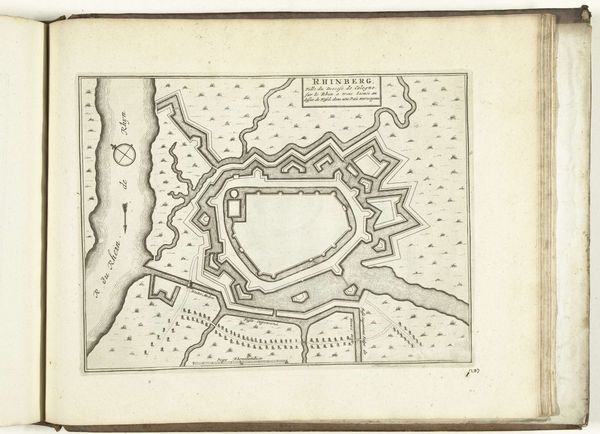
This "Plattegrond van Rheinberg" is a print of a fortified city, made in 1703 by an anonymous Dutch artist. It offers insight into the military and urban planning strategies of the early 18th century. The image reveals much about the socio-political context of the time. Rheinberg, located in the Lower Rhine region, was a strategically important city, often contested during European conflicts. The map emphasizes the city's fortifications - bastions, moats, and defensive walls - reflecting the constant threat of war and siege. The surrounding landscape is meticulously depicted, illustrating the relationship between the city and its environment, including the Rhine River's role in trade and defense. The institutional context is suggested by the map’s precision, perhaps commissioned by military authorities or wealthy merchants keen to invest in or defend the city. Studying such images requires an interdisciplinary approach. Historians can examine military records, urban plans, and economic data to understand the strategic, social, and economic significance of places like Rheinberg. Art reveals its deeper meaning only when we consider its place in social and institutional history.
Comments
No comments
Be the first to comment and join the conversation on the ultimate creative platform.
More like this