drawing, coloured-pencil, print, etching, paper, ink
#
drawing
#
coloured-pencil
#
baroque
# print
#
etching
#
paper
#
ink
#
coloured pencil
#
cityscape
Dimensions: height 121 mm, width 179 mm
Copyright: Rijks Museum: Open Domain
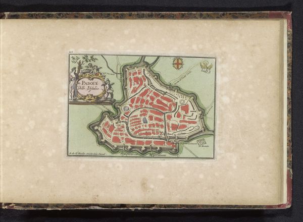
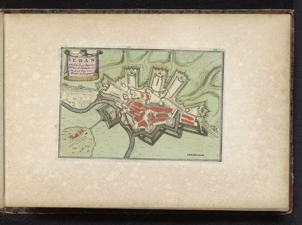
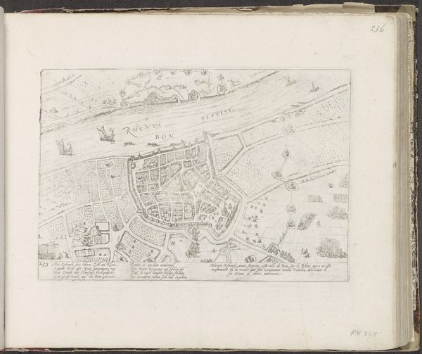
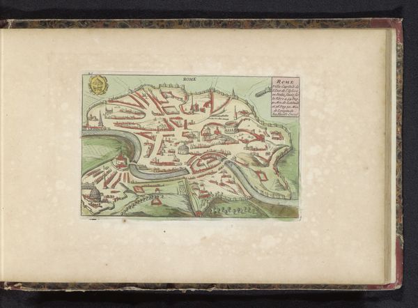
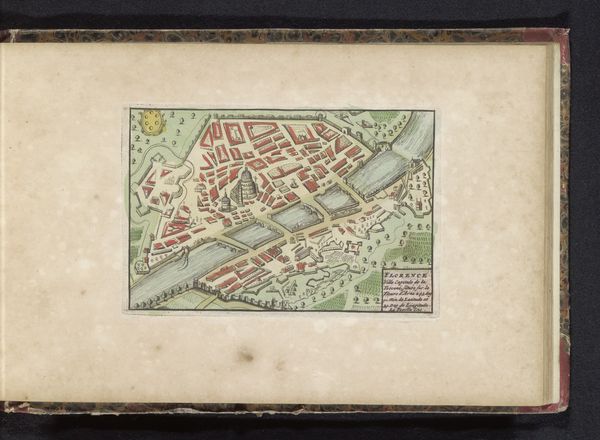
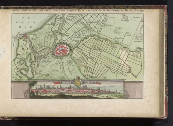
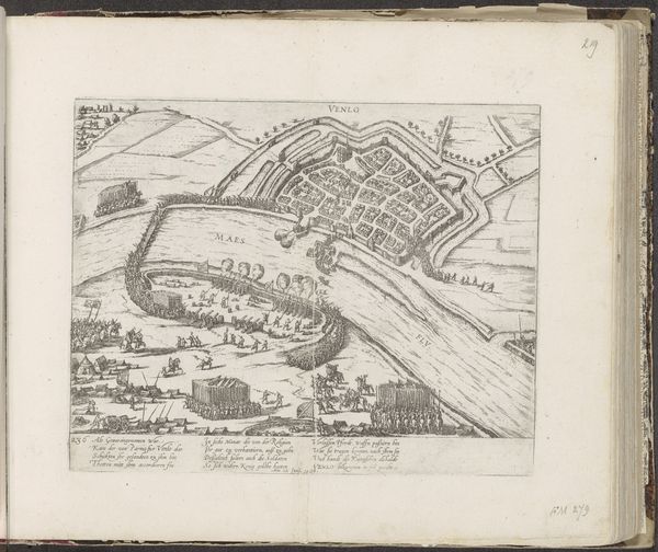
Curator: Here we have a print titled "Plattegrond van Luik," dating back to 1735. It’s a detailed plan of the city of Liège, executed with etching, ink, and colored pencil on paper. Editor: My first impression is of order and control. The vibrant, precise lines suggest an era concerned with boundaries and fortifications. The color palette is restrained, which somehow amplifies the feeling of meticulous planning. Curator: Absolutely. These city plans weren’t just about topography; they were powerful tools of governance and military strategy. Note how the walls and defenses are emphasized, illustrating Liège’s strategic importance in the 18th century. We have to consider the role of printmaking in disseminating power. Editor: Precisely. It reminds us that knowledge is never neutral. These images visually codified power structures, shaping how people understood their place within the city and, by extension, the wider sociopolitical system. Who had access to these maps, and how did they use them? It creates an immediate visual hierarchy, does it not? Curator: Certainly. Maps like these would likely have been commissioned by and circulated among the ruling elite – nobility, military leaders, merchants – reinforcing their authority. But prints also had a wider circulation compared to, say, painted portraits of rulers. So what messages are people internalizing looking at this then? Editor: A critical question, particularly when you consider how urban planning often reflects and perpetuates social inequalities. You see that even within a bird’s eye view; how resources were allocated and which areas were prioritized is an interesting conversation about identity in place. And Liège, like many cities, experienced its fair share of social stratification. Curator: Indeed. It's vital to remember the role of imagery in justifying socio-political decisions. Here in our modern world, these maps represent stability, Baroque era. These kinds of city maps could offer the sense of stability and organization, that may be a little more complex than it originally presents Editor: Agreed. While seemingly objective, even technical drawings reflect ideologies and serve specific interests. Analyzing who created this and why provides critical perspective into society at the time. So next time you are in Luik, maybe check your sense of belonging with how it presents to your person and your story, perhaps? Curator: Thank you for that perspective. It encourages a rich and important interpretation, wouldn't you agree?
Comments
No comments
Be the first to comment and join the conversation on the ultimate creative platform.
More like this